Allier, Hautes-Pyrénées
Allier
Alèir (Occitan) | |
|---|---|
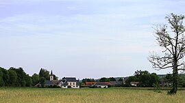 View of ville Allier | |
 Coat of arms | |
show Location of Allier | |
 Allier | |
| Coordinates: 43°10′41″N 0°07′24″E / 43.1781°N 0.1233°ECoordinates: 43°10′41″N 0°07′24″E / 43.1781°N 0.1233°E | |
| Country | France |
| Region | Occitanie |
| Department | Hautes-Pyrénées |
| Arrondissement | Tarbes |
| Canton | Moyen Adour |
| Intercommunality | CA Tarbes-Lourdes-Pyrénées |
| Government | |
| • Mayor (2020–2026) | Jean-Philippe Baklouti |
| Area 1 | 3.69 km2 (1.42 sq mi) |
| Population (Jan. 2018)[1] | 422 |
| • Density | 110/km2 (300/sq mi) |
| Time zone | UTC+01:00 (CET) |
| • Summer (DST) | UTC+02:00 (CEST) |
| INSEE/Postal code | 65005 /65360 |
| Elevation | 368–503 m (1,207–1,650 ft) (avg. 398 m or 1,306 ft) |
| 1 French Land Register data, which excludes lakes, ponds, glaciers > 1 km2 (0.386 sq mi or 247 acres) and river estuaries. | |


Allier (French pronunciation: [alje] (![]() listen); Occitan: Alièr) is a commune in the Hautes-Pyrénées department in southwestern France.
listen); Occitan: Alièr) is a commune in the Hautes-Pyrénées department in southwestern France.
Population[]
| Year | Pop. | ±% |
|---|---|---|
| 1962 | 106 | — |
| 1968 | 106 | +0.0% |
| 1975 | 194 | +83.0% |
| 1982 | 232 | +19.6% |
| 1990 | 220 | −5.2% |
| 1999 | 264 | +20.0% |
| 2006 | 383 | +45.1% |
| 2009 | 378 | −1.3% |
See also[]
References[]
- ^ "Populations légales 2018". INSEE. 28 December 2020.
| Wikimedia Commons has media related to Allier (Hautes-Pyrénées). |
This Hautes-Pyrénées geographical article is a stub. You can help Wikipedia by . |
Categories:
- Communes of Hautes-Pyrénées
- Hautes-Pyrénées geography stubs