Lau-Balagnas
Lau-Balagnas | |
|---|---|
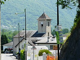 The church of Saint-Laurent | |
 Coat of arms | |
show Location of Lau-Balagnas | |
 Lau-Balagnas | |
| Coordinates: 42°59′48″N 0°05′27″W / 42.9967°N 0.0908°WCoordinates: 42°59′48″N 0°05′27″W / 42.9967°N 0.0908°W | |
| Country | France |
| Region | Occitanie |
| Department | Hautes-Pyrénées |
| Arrondissement | Argelès-Gazost |
| Canton | La Vallée des Gaves |
| Intercommunality | Pyrénées Vallées des Gaves |
| Government | |
| • Mayor (2008–2014) | Maryse Carrère (PRG) |
| Area 1 | 2.9 km2 (1.1 sq mi) |
| Population (Jan. 2018)[1] | 520 |
| • Density | 180/km2 (460/sq mi) |
| Time zone | UTC+01:00 (CET) |
| • Summer (DST) | UTC+02:00 (CEST) |
| INSEE/Postal code | 65267 /65400 |
| Elevation | 419–573 m (1,375–1,880 ft) (avg. 476 m or 1,562 ft) |
| 1 French Land Register data, which excludes lakes, ponds, glaciers > 1 km2 (0.386 sq mi or 247 acres) and river estuaries. | |


Lau-Balagnas is a commune in the Hautes-Pyrénées department in south-western France.
See also[]
References[]
- ^ "Populations légales 2018". INSEE. 28 December 2020.
| Wikimedia Commons has media related to Lau-Balagnas. |
This Hautes-Pyrénées geographical article is a stub. You can help Wikipedia by . |
Categories:
- Communes of Hautes-Pyrénées
- Hautes-Pyrénées geography stubs