Guchen
Guchen | |
|---|---|
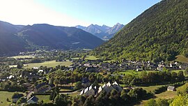 A general view of Guchen | |
 Coat of arms | |
show Location of Guchen | |
 Guchen | |
| Coordinates: 42°51′50″N 0°20′17″E / 42.8639°N 0.3381°ECoordinates: 42°51′50″N 0°20′17″E / 42.8639°N 0.3381°E | |
| Country | France |
| Region | Occitanie |
| Department | Hautes-Pyrénées |
| Arrondissement | Bagnères-de-Bigorre |
| Canton | Neste, Aure et Louron |
| Intercommunality | Aure-Louron |
| Government | |
| • Mayor (2008–2014) | Michel Fort |
| Area 1 | 5.55 km2 (2.14 sq mi) |
| Population (Jan. 2018)[1] | 330 |
| • Density | 59/km2 (150/sq mi) |
| Time zone | UTC+01:00 (CET) |
| • Summer (DST) | UTC+02:00 (CEST) |
| INSEE/Postal code | 65212 /65440 |
| Elevation | 751–1,659 m (2,464–5,443 ft) (avg. 772 m or 2,533 ft) |
| 1 French Land Register data, which excludes lakes, ponds, glaciers > 1 km2 (0.386 sq mi or 247 acres) and river estuaries. | |


Guchen is a commune in the Hautes-Pyrénées department in south-western France.
See also[]
References[]
- ^ "Populations légales 2018". INSEE. 28 December 2020.
| Wikimedia Commons has media related to Guchen. |
This Hautes-Pyrénées geographical article is a stub. You can help Wikipedia by . |
Categories:
- Communes of Hautes-Pyrénées
- Hautes-Pyrénées geography stubs