Bun, Hautes-Pyrénées
Bun | |
|---|---|
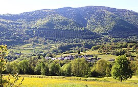 View of Bun | |
 Coat of arms | |
show Location of Bun | |
 Bun | |
| Coordinates: 42°58′33″N 0°09′20″W / 42.9758°N 0.1556°WCoordinates: 42°58′33″N 0°09′20″W / 42.9758°N 0.1556°W | |
| Country | France |
| Region | Occitanie |
| Department | Hautes-Pyrénées |
| Arrondissement | Argelès-Gazost |
| Canton | La Vallée des Gaves |
| Government | |
| • Mayor (2008–2014) | Michel Cazajous |
| Area 1 | 2.8 km2 (1.1 sq mi) |
| Population (Jan. 2018)[1] | 151 |
| • Density | 54/km2 (140/sq mi) |
| Time zone | UTC+01:00 (CET) |
| • Summer (DST) | UTC+02:00 (CEST) |
| INSEE/Postal code | 65112 /65400 |
| Elevation | 673–1,345 m (2,208–4,413 ft) (avg. 830 m or 2,720 ft) |
| 1 French Land Register data, which excludes lakes, ponds, glaciers > 1 km2 (0.386 sq mi or 247 acres) and river estuaries. | |


Bun is a commune in the Hautes-Pyrénées department in southwestern France.
Population[]
| Year | Pop. | ±% |
|---|---|---|
| 1962 | 123 | — |
| 1968 | 126 | +2.4% |
| 1975 | 113 | −10.3% |
| 1982 | 105 | −7.1% |
| 1990 | 101 | −3.8% |
| 1999 | 108 | +6.9% |
| 2006 | 129 | +19.4% |
| 2009 | 167 | +29.5% |
See also[]
References[]
- ^ "Populations légales 2018". INSEE. 28 December 2020.
| Wikimedia Commons has media related to Bun (Hautes-Pyrénées). |
This Hautes-Pyrénées geographical article is a stub. You can help Wikipedia by . |
Categories:
- Communes of Hautes-Pyrénées
- Hautes-Pyrénées geography stubs