Bouilh-Péreuilh
Bouilh-Péreuilh | |
|---|---|
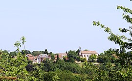 View of Bouilh-Péreuilh | |
show Location of Bouilh-Péreuilh | |
 Bouilh-Péreuilh | |
| Coordinates: 43°18′28″N 0°11′18″E / 43.3078°N 0.1883°ECoordinates: 43°18′28″N 0°11′18″E / 43.3078°N 0.1883°E | |
| Country | France |
| Region | Occitanie |
| Department | Hautes-Pyrénées |
| Arrondissement | Tarbes |
| Canton | Les Coteaux |
| Intercommunality | Coteaux du Val d'Arros |
| Area 1 | 7.85 km2 (3.03 sq mi) |
| Population (Jan. 2018)[1] | 101 |
| • Density | 13/km2 (33/sq mi) |
| Time zone | UTC+01:00 (CET) |
| • Summer (DST) | UTC+02:00 (CEST) |
| INSEE/Postal code | 65103 /65350 |
| Elevation | 219–351 m (719–1,152 ft) (avg. 340 m or 1,120 ft) |
| 1 French Land Register data, which excludes lakes, ponds, glaciers > 1 km2 (0.386 sq mi or 247 acres) and river estuaries. | |


Bouilh-Péreuilh is a commune in the Hautes-Pyrénées department in southwestern France.
Population[]
| Year | Pop. | ±% |
|---|---|---|
| 1962 | 80 | — |
| 1968 | 84 | +5.0% |
| 1975 | 84 | +0.0% |
| 1982 | 93 | +10.7% |
| 1990 | 90 | −3.2% |
| 1999 | 88 | −2.2% |
| 2007 | 99 | +12.5% |
| 2009 | 102 | +3.0% |
See also[]
References[]
- ^ "Populations légales 2018". INSEE. 28 December 2020.
| Wikimedia Commons has media related to Bouilh-Péreuilh. |
This Hautes-Pyrénées geographical article is a stub. You can help Wikipedia by . |
Categories:
- Communes of Hautes-Pyrénées
- Hautes-Pyrénées geography stubs