Saint-Pastous
Saint-Pastous | |
|---|---|
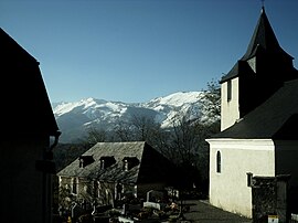 The church of Saint-Pastous | |
 Coat of arms | |
show Location of Saint-Pastous | |
 Saint-Pastous | |
| Coordinates: 43°00���53″N 0°03′27″W / 43.0147°N 0.0575°WCoordinates: 43°00′53″N 0°03′27″W / 43.0147°N 0.0575°W | |
| Country | France |
| Region | Occitanie |
| Department | Hautes-Pyrénées |
| Arrondissement | Argelès-Gazost |
| Canton | La Vallée des Gaves |
| Intercommunality | Pyrénées Vallées des Gaves |
| Area 1 | 8.2 km2 (3.2 sq mi) |
| Population (Jan. 2018)[1] | 138 |
| • Density | 17/km2 (44/sq mi) |
| Time zone | UTC+01:00 (CET) |
| • Summer (DST) | UTC+02:00 (CEST) |
| INSEE/Postal code | 65393 /65400 |
| Elevation | 420–1,661 m (1,378–5,449 ft) (avg. 500 m or 1,600 ft) |
| 1 French Land Register data, which excludes lakes, ponds, glaciers > 1 km2 (0.386 sq mi or 247 acres) and river estuaries. | |


Saint-Pastous is a commune in the Hautes-Pyrénées department in south-western France.
See also[]
References[]
- ^ "Populations légales 2018". INSEE. 28 December 2020.
| Wikimedia Commons has media related to Saint-Pastous. |
This Hautes-Pyrénées geographical article is a stub. You can help Wikipedia by . |
Categories:
- Communes of Hautes-Pyrénées
- Hautes-Pyrénées geography stubs