Hitte
Hitte | |
|---|---|
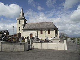 The church | |
 Coat of arms | |
show Location of Hitte | |
 Hitte | |
| Coordinates: 43°09′03″N 0°09′55″E / 43.1508°N 0.1653°ECoordinates: 43°09′03″N 0°09′55″E / 43.1508°N 0.1653°E | |
| Country | France |
| Region | Occitanie |
| Department | Hautes-Pyrénées |
| Arrondissement | Tarbes |
| Canton | La Vallée de l'Arros et des Baïses |
| Intercommunality | Haute-Bigorre |
| Government | |
| • Mayor (2020–2026) | Laurence Le Guennic |
| Area 1 | 2.91 km2 (1.12 sq mi) |
| Population (Jan. 2018)[1] | 164 |
| • Density | 56/km2 (150/sq mi) |
| Time zone | UTC+01:00 (CET) |
| • Summer (DST) | UTC+02:00 (CEST) |
| INSEE/Postal code | 65222 /65190 |
| Elevation | 360–540 m (1,180–1,770 ft) (avg. 500 m or 1,600 ft) |
| 1 French Land Register data, which excludes lakes, ponds, glaciers > 1 km2 (0.386 sq mi or 247 acres) and river estuaries. | |


Hitte (French pronunciation: [it]; Occitan: Hita) is a commune in the Hautes-Pyrénées department in south-western France.
See also[]
References[]
- ^ "Populations légales 2018". INSEE. 28 December 2020.
| Wikimedia Commons has media related to Hitte. |
This Hautes-Pyrénées geographical article is a stub. You can help Wikipedia by . |
Categories:
- Communes of Hautes-Pyrénées
- Hautes-Pyrénées geography stubs