Aubord
Aubord | |
|---|---|
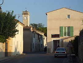 A view of Aubord | |
 Coat of arms | |
show Location of Aubord | |
 Aubord | |
| Coordinates: 43°45′28″N 4°18′47″E / 43.7578°N 4.3131°ECoordinates: 43°45′28″N 4°18′47″E / 43.7578°N 4.3131°E | |
| Country | France |
| Region | Occitanie |
| Department | Gard |
| Arrondissement | Nîmes |
| Canton | Vauvert |
| Intercommunality | CC Petite Camargue |
| Government | |
| • Mayor (2020–2026) | André Brundu[1] |
| Area 1 | 9.42 km2 (3.64 sq mi) |
| Population (Jan. 2018)[2] | 2,367 |
| • Density | 250/km2 (650/sq mi) |
| Time zone | UTC+01:00 (CET) |
| • Summer (DST) | UTC+02:00 (CEST) |
| INSEE/Postal code | 30020 /30620 |
| Elevation | 17–64 m (56–210 ft) (avg. 14 m or 46 ft) |
| 1 French Land Register data, which excludes lakes, ponds, glaciers > 1 km2 (0.386 sq mi or 247 acres) and river estuaries. | |


Aubord (French pronunciation: [obɔʁ]; Occitan: Aubòrn) is a commune in the Gard department in southern France. Aubord is situated 15 km (9.3 mi) southwest of Nîmes.
Population[]
| Year | Pop. | ±% |
|---|---|---|
| 1962 | 249 | — |
| 1968 | 292 | +17.3% |
| 1975 | 483 | +65.4% |
| 1982 | 791 | +63.8% |
| 1990 | 1,607 | +103.2% |
| 1999 | 1,910 | +18.9% |
| 2008 | 2,416 | +26.5% |
| 2015 | 2,392 | −1.0% |
Personalities[]
The Franco-German geographer Christophe Neff has lived several years in Aubord. During this time he considered Aubord as his Home harbor in France.[3] In his blog he compared Aubord to the fictional village Macondo.[4]
See also[]
- Costières de Nîmes AOC
- Communes of the Gard department
References[]
- ^ "Répertoire national des élus: les maires". data.gouv.fr, Plateforme ouverte des données publiques françaises (in French). 2 December 2020.
- ^ "Populations légales 2018". INSEE. 28 December 2020.
- ^ "Fünf Jahre Paysagesblog auf Le Monde.fr".
- ^ "Aubord de " Macondo "".
| Wikimedia Commons has media related to Aubord. |
| show Communes of the Gard department |
|---|
This Gard geographical article is a stub. You can help Wikipedia by . |
Categories:
- Communes of Gard
- Gard geography stubs