Sanilhac-Sagriès
Sanilhac-Sagriès | |
|---|---|
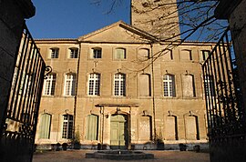 Chateau | |
 Coat of arms | |
show Location of Sanilhac-Sagriès | |
 Sanilhac-Sagriès | |
| Coordinates: 43°57′21″N 4°25′31″E / 43.9558°N 4.4253°ECoordinates: 43°57′21″N 4°25′31″E / 43.9558°N 4.4253°E | |
| Country | France |
| Region | Occitanie |
| Department | Gard |
| Arrondissement | Nîmes |
| Canton | Uzès |
| Government | |
| • Mayor (2008–2014) | Bernard Comte |
| Area 1 | 22.1 km2 (8.5 sq mi) |
| Population (Jan. 2018)[1] | 776 |
| • Density | 35/km2 (91/sq mi) |
| Time zone | UTC+01:00 (CET) |
| • Summer (DST) | UTC+02:00 (CEST) |
| INSEE/Postal code | 30308 /30700 |
| Elevation | 30–202 m (98–663 ft) (avg. 105 m or 344 ft) |
| 1 French Land Register data, which excludes lakes, ponds, glaciers > 1 km2 (0.386 sq mi or 247 acres) and river estuaries. | |


Sanilhac-Sagriès is a commune in the Gard department in southern France.
Population[]
| Year | Pop. | ±% |
|---|---|---|
| 1962 | 401 | — |
| 1968 | 440 | +9.7% |
| 1975 | 442 | +0.5% |
| 1982 | 525 | +18.8% |
| 1990 | 643 | +22.5% |
| 1999 | 785 | +22.1% |
| 2008 | 834 | +6.2% |
See also[]
- Communes of the Gard department
References[]
- ^ "Populations légales 2018". INSEE. 28 December 2020.
| Wikimedia Commons has media related to Sanilhac-Sagriès. |
| show Communes of the Gard department |
|---|
| show Authority control |
|---|
This Gard geographical article is a stub. You can help Wikipedia by . |
Categories:
- Communes of Gard
- Gard geography stubs