Codognan
Codognan | |
|---|---|
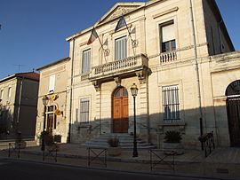 Town hall | |
show Location of Codognan | |
 Codognan | |
| Coordinates: 43°43′57″N 4°13′14″E / 43.7325°N 4.2206°ECoordinates: 43°43′57″N 4°13′14″E / 43.7325°N 4.2206°E | |
| Country | France |
| Region | Occitanie |
| Department | Gard |
| Arrondissement | Nîmes |
| Canton | Vauvert |
| Intercommunality | Rhôny Vistre Vidourle |
| Government | |
| • Mayor (2008–2014) | Michel Julien |
| Area 1 | 4.65 km2 (1.80 sq mi) |
| Population (Jan. 2018)[1] | 2,418 |
| • Density | 520/km2 (1,300/sq mi) |
| Time zone | UTC+01:00 (CET) |
| • Summer (DST) | UTC+02:00 (CEST) |
| INSEE/Postal code | 30083 /30920 |
| Elevation | 10–21 m (33–69 ft) (avg. 17 m or 56 ft) |
| 1 French Land Register data, which excludes lakes, ponds, glaciers > 1 km2 (0.386 sq mi or 247 acres) and river estuaries. | |


Codognan is a commune in the Gard department in southern France.
Population[]
| Year | Pop. | ±% |
|---|---|---|
| 1962 | 841 | — |
| 1968 | 883 | +5.0% |
| 1975 | 1,052 | +19.1% |
| 1982 | 1,310 | +24.5% |
| 1990 | 1,760 | +34.4% |
| 1999 | 1,940 | +10.2% |
| 2008 | 2,488 | +28.2% |
See also[]
- Communes of the Gard department
References[]
- ^ "Populations légales 2018". INSEE. 28 December 2020.
| Wikimedia Commons has media related to Codognan. |
| show Communes of the Gard department |
|---|
This Gard geographical article is a stub. You can help Wikipedia by . |
Categories:
- Communes of Gard
- Gard geography stubs