Savignargues
Savignargues | |
|---|---|
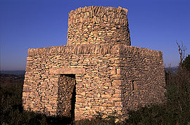 Dry stone cabin | |
 Coat of arms | |
show Location of Savignargues | |
 Savignargues | |
| Coordinates: 43°57′47″N 4°05′02″E / 43.9631°N 4.0839°ECoordinates: 43°57′47″N 4°05′02″E / 43.9631°N 4.0839°E | |
| Country | France |
| Region | Occitanie |
| Department | Gard |
| Arrondissement | Le Vigan |
| Canton | Quissac |
| Government | |
| • Mayor (2020–2026) | Stéphanie Laurent[1] |
| Area 1 | 2.77 km2 (1.07 sq mi) |
| Population (Jan. 2018)[2] | 237 |
| • Density | 86/km2 (220/sq mi) |
| Time zone | UTC+01:00 (CET) |
| • Summer (DST) | UTC+02:00 (CEST) |
| INSEE/Postal code | 30314 /30350 |
| Elevation | 97–142 m (318–466 ft) (avg. 84 m or 276 ft) |
| 1 French Land Register data, which excludes lakes, ponds, glaciers > 1 km2 (0.386 sq mi or 247 acres) and river estuaries. | |


Savignargues (French pronunciation: [saviɲaʁg]; Occitan: Savinhargues) is a commune in the Gard department in southern France.
Population[]
| Year | Pop. | ±% |
|---|---|---|
| 1962 | 113 | — |
| 1968 | 114 | +0.9% |
| 1975 | 121 | +6.1% |
| 1982 | 123 | +1.7% |
| 1990 | 144 | +17.1% |
| 1999 | 142 | −1.4% |
| 2008 | 204 | +43.7% |
See also[]
- Communes of the Gard department
References[]
- ^ "Répertoire national des élus: les maires". data.gouv.fr, Plateforme ouverte des données publiques françaises (in French). 2 December 2020. Retrieved 7 December 2020.
- ^ "Populations légales 2018". INSEE. 28 December 2020.
| Wikimedia Commons has media related to Savignargues. |
| show Communes of the Gard department |
|---|
This Gard geographical article is a stub. You can help Wikipedia by . |
Categories:
- Communes of Gard
- Gard geography stubs