Monteils, Gard
Monteils | |
|---|---|
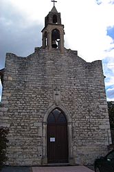 The church of Monteils | |
 Coat of arms | |
show Location of Monteils | |
 Monteils | |
| Coordinates: 44°05′24″N 4°10′56″E / 44.09°N 4.1822°ECoordinates: 44°05′24″N 4°10′56″E / 44.09°N 4.1822°E | |
| Country | France |
| Region | Occitanie |
| Department | Gard |
| Arrondissement | Alès |
| Canton | Alès-3 |
| Intercommunality | Alès Agglomération |
| Government | |
| • Mayor (2008–2014) | Serge Constant |
| Area 1 | 6.98 km2 (2.69 sq mi) |
| Population (Jan. 2018)[1] | 652 |
| • Density | 93/km2 (240/sq mi) |
| Time zone | UTC+01:00 (CET) |
| • Summer (DST) | UTC+02:00 (CEST) |
| INSEE/Postal code | 30177 /30360 |
| Elevation | 117–248 m (384–814 ft) (avg. 191 m or 627 ft) |
| 1 French Land Register data, which excludes lakes, ponds, glaciers > 1 km2 (0.386 sq mi or 247 acres) and river estuaries. | |


Monteils is a commune in the Gard department in southern France.
Population[]
| Year | Pop. | ±% |
|---|---|---|
| 1793 | 312 | — |
| 1821 | 283 | −9.3% |
| 1846 | 295 | +4.2% |
| 1872 | 253 | −14.2% |
| 1901 | 147 | −41.9% |
| 1926 | 123 | −16.3% |
| 1946 | 100 | −18.7% |
| 1962 | 106 | +6.0% |
| 1968 | 106 | +0.0% |
| 1975 | 142 | +34.0% |
| 1982 | 200 | +40.8% |
| 1990 | 324 | +62.0% |
| 1999 | 399 | +23.1% |
| 2008 | 595 | +49.1% |
See also[]
- Communes of the Gard department
References[]
- ^ "Populations légales 2018". INSEE. 28 December 2020.
| Wikimedia Commons has media related to Monteils (Gard). |
| show Communes of the Gard department |
|---|
This Gard geographical article is a stub. You can help Wikipedia by . |
Categories:
- Communes of Gard
- Gard geography stubs