Saint-Denis, Gard
Saint-Denis | |
|---|---|
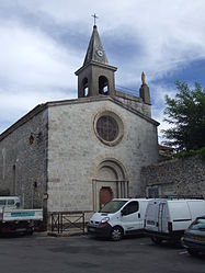 The church of Saint-Denis | |
 Coat of arms | |
show Location of Saint-Denis | |
 Saint-Denis | |
| Coordinates: 44°14′02″N 4°15′09″E / 44.2339°N 4.2525°ECoordinates: 44°14′02″N 4°15′09″E / 44.2339°N 4.2525°E | |
| Country | France |
| Region | Occitanie |
| Department | Gard |
| Arrondissement | Alès |
| Canton | Rousson |
| Government | |
| • Mayor (2020–2026) | Sylvette Molieres[1] |
| Area 1 | 3.65 km2 (1.41 sq mi) |
| Population (Jan. 2018)[2] | 291 |
| • Density | 80/km2 (210/sq mi) |
| Time zone | UTC+01:00 (CET) |
| • Summer (DST) | UTC+02:00 (CEST) |
| INSEE/Postal code | 30247 /30500 |
| Elevation | 111–156 m (364–512 ft) (avg. 200 m or 660 ft) |
| 1 French Land Register data, which excludes lakes, ponds, glaciers > 1 km2 (0.386 sq mi or 247 acres) and river estuaries. | |


Saint-Denis (Occitan: Sent Daunís) is a commune in the Gard department in southern France. It is around 15 km north-east of Alès.
Population[]
|
|
See also[]
- Communes of the Gard department
References[]
- ^ "Répertoire national des élus: les maires". data.gouv.fr, Plateforme ouverte des données publiques françaises (in French). 2 December 2020. Retrieved 7 December 2020.
- ^ "Populations légales 2018". INSEE. 28 December 2020.
| Wikimedia Commons has media related to Saint-Denis (Gard). |
| show Communes of the Gard department |
|---|
This Gard geographical article is a stub. You can help Wikipedia by . |
Categories:
- Communes of Gard
- Gard geography stubs