Théziers
Théziers | |
|---|---|
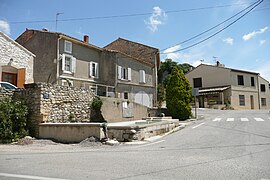 A view of Théziers | |
 Coat of arms | |
show Location of Théziers | |
 Théziers | |
| Coordinates: 43°54′00″N 4°37′18″E / 43.9°N 4.6217°ECoordinates: 43°54′00″N 4°37′18″E / 43.9°N 4.6217°E | |
| Country | France |
| Region | Occitanie |
| Department | Gard |
| Arrondissement | Nîmes |
| Canton | Redessan |
| Intercommunality | Pont du Gard |
| Government | |
| • Mayor (2020–2026) | Murielle Garcia-Favand |
| Area 1 | 11.34 km2 (4.38 sq mi) |
| Population (Jan. 2018)[1] | 1,045 |
| • Density | 92/km2 (240/sq mi) |
| Time zone | UTC+01:00 (CET) |
| • Summer (DST) | UTC+02:00 (CEST) |
| INSEE/Postal code | 30328 /30390 |
| Elevation | 10–129 m (33–423 ft) (avg. 20 m or 66 ft) |
| 1 French Land Register data, which excludes lakes, ponds, glaciers > 1 km2 (0.386 sq mi or 247 acres) and river estuaries. | |


Théziers (French pronunciation: [tezje]; Occitan: Tesiers) is a commune in the Gard department in the Occitanie region in southern France.
History[]
Théziers was founded in the 6th century BC by Greek colonists, who, after they had founded the coastal town of Marseille (Greek: Μασσαλία), advanced inland to found smaller colonies in the periphery. The ancient name of the town was Tedusia (Greek: Θεδουσία), under which the town was known during the Roman times. It was a fortified settlement situated on a hill, which was captured by the Celts during their invasions in the 2nd century BC. Gradually the Romans occupied the Gaul and expelled the Celts, while the settlement evolved as a Gallo-Roman village.
Population[]
| Year | Pop. | ±% |
|---|---|---|
| 1962 | 640 | — |
| 1968 | 678 | +5.9% |
| 1975 | 659 | −2.8% |
| 1982 | 674 | +2.3% |
| 1990 | 844 | +25.2% |
| 1999 | 883 | +4.6% |
| 2008 | 1,016 | +15.1% |
See also[]
- Communes of the Gard department
References[]
- ^ "Populations légales 2018". INSEE. 28 December 2020.
| Wikimedia Commons has media related to Théziers. |
| show Communes of the Gard department |
|---|
| show Authority control |
|---|
This Gard geographical article is a stub. You can help Wikipedia by . |
- Communes of Gard
- Gard geography stubs