Auvers-le-Hamon
Auvers-le-Hamon | |
|---|---|
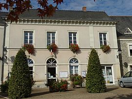 The town hall of Auvers-le-Hamon | |
show Location of Auvers-le-Hamon | |
 Auvers-le-Hamon | |
| Coordinates: 47°54′11″N 0°21′02″W / 47.9031°N 0.350555°WCoordinates: 47°54′11″N 0°21′02″W / 47.9031°N 0.350555°W | |
| Country | France |
| Region | Pays de la Loire |
| Department | Sarthe |
| Arrondissement | La Flèche |
| Canton | Sablé-sur-Sarthe |
| Intercommunality | |
| Government | |
| • Mayor (2014-2020) | Jean-Pierre Legay |
| Area 1 | 47.83 km2 (18.47 sq mi) |
| Population (Jan. 2018)[1] | 1,472 |
| • Density | 31/km2 (80/sq mi) |
| Demonym(s) | Auversois, Auversoise |
| Time zone | UTC+01:00 (CET) |
| • Summer (DST) | UTC+02:00 (CEST) |
| INSEE/Postal code | 72016 /72300 |
| Elevation | 29–93 m (95–305 ft) |
| 1 French Land Register data, which excludes lakes, ponds, glaciers > 1 km2 (0.386 sq mi or 247 acres) and river estuaries. | |


Auvers-le-Hamon is a commune in the Sarthe department in the region of Pays de la Loire in north-western France.
Geography[]
The Vaige forms part of the commune's south-western border.
See also[]
- Communes of the Sarthe department
References[]
- ^ "Populations légales 2018". INSEE. 28 December 2020.
| Wikimedia Commons has media related to Auvers-le-Hamon. |
| show Communes of the Sarthe department |
|---|
This Sarthe geographical article is a stub. You can help Wikipedia by . |
Categories:
- Communes of Sarthe
- Sarthe geography stubs