Pontvallain
Pontvallain | |
|---|---|
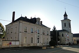 The town hall and church of Saint-Pierre and Saint-Paul | |
show Location of Pontvallain | |
 Pontvallain | |
| Coordinates: 47°45′03″N 0°11′32″E / 47.7508°N 0.1922°ECoordinates: 47°45′03″N 0°11′32″E / 47.7508°N 0.1922°E | |
| Country | France |
| Region | Pays de la Loire |
| Department | Sarthe |
| Arrondissement | La Flèche |
| Canton | Le Lude |
| Intercommunality | Sud Sarthe |
| Government | |
| • Mayor (2020–2026) | Xavier Gayat |
| Area 1 | 34.88 km2 (13.47 sq mi) |
| Population (Jan. 2018)[1] | 1,662 |
| • Density | 48/km2 (120/sq mi) |
| Demonym(s) | Vallipontain, Vallipontaine |
| Time zone | UTC+01:00 (CET) |
| • Summer (DST) | UTC+02:00 (CEST) |
| INSEE/Postal code | 72243 /72510 |
| Elevation | 42–111 m (138–364 ft) |
| 1 French Land Register data, which excludes lakes, ponds, glaciers > 1 km2 (0.386 sq mi or 247 acres) and river estuaries. | |


Pontvallain (French pronunciation: [pɔ̃valɛ̃]) is a commune in the Sarthe department in the region of Pays de la Loire in north-western France.
It was the site, on 4 December 1370, of the Battle of Pontvallain, a significant military engagement between England and France (who had the victory) during the Hundred Years' War.[2]
See also[]
- Communes of the Sarthe department
References[]
- ^ "Populations légales 2018". INSEE. 28 December 2020.
- ^ Sumption 2012, pp. 89-95.
| Wikimedia Commons has media related to Pontvallain. |
| show Communes of the Sarthe department |
|---|
This Sarthe geographical article is a stub. You can help Wikipedia by . |
Categories:
- Communes of Sarthe
- Sarthe geography stubs