Chassillé
Chassillé | |
|---|---|
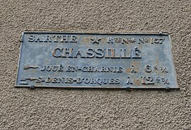 Plaque beside the old National Route 157 | |
show Location of Chassillé | |
 Chassillé | |
| Coordinates: 48°01′16″N 0°06′53″W / 48.0211°N 0.1147°WCoordinates: 48°01′16″N 0°06′53″W / 48.0211°N 0.1147°W | |
| Country | France |
| Region | Pays de la Loire |
| Department | Sarthe |
| Arrondissement | La Flèche |
| Canton | Loué |
| Intercommunality | Loué - Brûlon - Noyen |
| Government | |
| • Mayor (2020–2026) | Michel Legendre[1] |
| Area 1 | 7.3 km2 (2.8 sq mi) |
| Population (Jan. 2018)[2] | 243 |
| • Density | 33/km2 (86/sq mi) |
| Demonym(s) | Coquins, Coquine |
| Time zone | UTC+01:00 (CET) |
| • Summer (DST) | UTC+02:00 (CEST) |
| INSEE/Postal code | 72070 /72540 |
| 1 French Land Register data, which excludes lakes, ponds, glaciers > 1 km2 (0.386 sq mi or 247 acres) and river estuaries. | |


Chassillé (French pronunciation: [ʃasije]) is a commune in the Sarthe department in the Pays de la Loire region in north-western France.
Geography[]
The village lies on the right bank of the Vègre, which flows southwestward through the commune.
See also[]
- Communes of the Sarthe department
References[]
- ^ "Répertoire national des élus: les maires". data.gouv.fr, Plateforme ouverte des données publiques françaises (in French). 2 December 2020.
- ^ "Populations légales 2018". INSEE. 28 December 2020.
| Wikimedia Commons has media related to Chassillé. |
| show Communes of the Sarthe department |
|---|
This Sarthe geographical article is a stub. You can help Wikipedia by . |
Categories:
- Communes of Sarthe
- Sarthe geography stubs