La Chapelle-Saint-Aubin
La Chapelle-Saint-Aubin | |
|---|---|
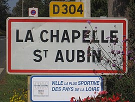 A road sign at the entrance to La Chapelle-Saint-Aubin | |
show Location of La Chapelle-Saint-Aubin | |
 La Chapelle-Saint-Aubin | |
| Coordinates: 48°02′10″N 0°09′41″E / 48.0361°N 0.1614°ECoordinates: 48°02′10″N 0°09′41″E / 48.0361°N 0.1614°E | |
| Country | France |
| Region | Pays de la Loire |
| Department | Sarthe |
| Arrondissement | Le Mans |
| Canton | Le Mans-2 |
| Intercommunality | Le Mans Métropole |
| Government | |
| • Mayor (2020–2026) | Joël Le Bolu[1] |
| Area 1 | 5.93 km2 (2.29 sq mi) |
| Population (Jan. 2018)[2] | 2,331 |
| • Density | 390/km2 (1,000/sq mi) |
| Demonym(s) | Capellaubinois, Capellaubinoise |
| Time zone | UTC+01:00 (CET) |
| • Summer (DST) | UTC+02:00 (CEST) |
| INSEE/Postal code | 72065 /72650 |
| Elevation | 42–128 m (138–420 ft) |
| 1 French Land Register data, which excludes lakes, ponds, glaciers > 1 km2 (0.386 sq mi or 247 acres) and river estuaries. | |


La Chapelle-Saint-Aubin is a commune in the Sarthe department in the Pays de la Loire region in north-western France.
See also[]
- Communes of the Sarthe department
References[]
- ^ "Répertoire national des élus: les maires". data.gouv.fr, Plateforme ouverte des données publiques françaises (in French). 2 December 2020.
- ^ "Populations légales 2018". INSEE. 28 December 2020.
| Wikimedia Commons has media related to La Chapelle-Saint-Aubin. |
| show Communes of the Sarthe department |
|---|
| show Authority control |
|---|
This Sarthe geographical article is a stub. You can help Wikipedia by . |
Categories:
- Communes of Sarthe
- Sarthe geography stubs