La Chapelle-d'Aligné
La Chapelle-d'Aligné | |
|---|---|
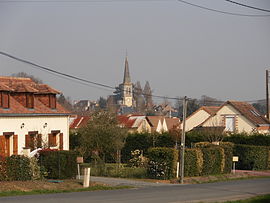 View of the Chapelle-d'Aligné | |
show Location of La Chapelle-d'Aligné | |
 La Chapelle-d'Aligné | |
| Coordinates: 47°44′00″N 0°14′00″W / 47.7333°N 0.2333°WCoordinates: 47°44′00″N 0°14′00″W / 47.7333°N 0.2333°W | |
| Country | France |
| Region | Pays de la Loire |
| Department | Sarthe |
| Arrondissement | La Flèche |
| Canton | La Flèche |
| Intercommunality | Pays Fléchois |
| Government | |
| • Mayor (2020–2026) | Philippe Deslandes[1] |
| Area 1 | 33.04 km2 (12.76 sq mi) |
| Population (Jan. 2018)[2] | 1,698 |
| • Density | 51/km2 (130/sq mi) |
| Demonym(s) | Chapellois, Chapelloise |
| Time zone | UTC+01:00 (CET) |
| • Summer (DST) | UTC+02:00 (CEST) |
| INSEE/Postal code | 72061 /72300 |
| Elevation | 51–51 m (167–167 ft) |
| 1 French Land Register data, which excludes lakes, ponds, glaciers > 1 km2 (0.386 sq mi or 247 acres) and river estuaries. | |


La Chapelle-d'Aligné is a commune in the Sarthe department in the Pays de la Loire region in north-western France.
See also[]
- Communes of the Sarthe department
References[]
- ^ "Répertoire national des élus: les maires". data.gouv.fr, Plateforme ouverte des données publiques françaises (in French). 2 December 2020.
- ^ "Populations légales 2018". INSEE. 28 December 2020.
| Wikimedia Commons has media related to La Chapelle-d'Aligné. |
| show Communes of the Sarthe department |
|---|
This Sarthe geographical article is a stub. You can help Wikipedia by . |
Categories:
- Communes of Sarthe
- Sarthe geography stubs