Souvigné-sur-Sarthe
Souvigné-sur-Sarthe | |
|---|---|
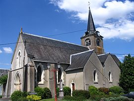 The church of Saint-Maurille | |
show Location of Souvigné-sur-Sarthe | |
 Souvigné-sur-Sarthe | |
| Coordinates: 47°49′36″N 0°23′16″W / 47.8267°N 0.3878°WCoordinates: 47°49′36″N 0°23′16″W / 47.8267°N 0.3878°W | |
| Country | France |
| Region | Pays de la Loire |
| Department | Sarthe |
| Arrondissement | La Flèche |
| Canton | Sablé-sur-Sarthe |
| Intercommunality | CC de Sablé-sur-Sarthe |
| Government | |
| • Mayor (2020–2026) | Mélanie Cosnier[1] |
| Area 1 | 17.06 km2 (6.59 sq mi) |
| Population (Jan. 2018)[2] | 625 |
| • Density | 37/km2 (95/sq mi) |
| Demonym(s) | Solviniacois, Solviniacoises Souvignéen, Souvignéenne |
| Time zone | UTC+01:00 (CET) |
| • Summer (DST) | UTC+02:00 (CEST) |
| INSEE/Postal code | 72343 /72300 |
| Elevation | 20–50 m (66–164 ft) |
| 1 French Land Register data, which excludes lakes, ponds, glaciers > 1 km2 (0.386 sq mi or 247 acres) and river estuaries. | |


Souvigné-sur-Sarthe is a commune in the Sarthe department in the region of Pays de la Loire in north-western France.
See also[]
- Communes of the Sarthe department
References[]
- ^ "Répertoire national des élus: les maires". data.gouv.fr, Plateforme ouverte des données publiques françaises (in French). 2 December 2020.
- ^ "Populations légales 2018". INSEE. 28 December 2020.
| Wikimedia Commons has media related to Souvigné-sur-Sarthe. |
| show Communes of the Sarthe department |
|---|
| show Authority control |
|---|
This Sarthe geographical article is a stub. You can help Wikipedia by . |
Categories:
- Communes of Sarthe
- Sarthe geography stubs