Saint-Georges-de-la-Couée
Saint-Georges-de-la-Couée | |
|---|---|
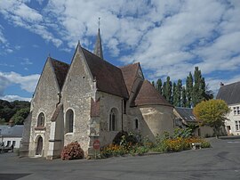 The church of Saint-Georges-de-la-Couée | |
show Location of Saint-Georges-de-la-Couée | |
 Saint-Georges-de-la-Couée | |
| Coordinates: 47°50′29″N 0°34′59″E / 47.8414°N 0.5831°ECoordinates: 47°50′29″N 0°34′59″E / 47.8414°N 0.5831°E | |
| Country | France |
| Region | Pays de la Loire |
| Department | Sarthe |
| Arrondissement | La Flèche |
| Canton | Château-du-Loir |
| Intercommunality | Loir-Lucé-Bercé |
| Government | |
| • Mayor (2020–2026) | Sylvain Bidier |
| Area 1 | 11.68 km2 (4.51 sq mi) |
| Population (Jan. 2018)[1] | 157 |
| • Density | 13/km2 (35/sq mi) |
| Time zone | UTC+01:00 (CET) |
| • Summer (DST) | UTC+02:00 (CEST) |
| INSEE/Postal code | 72279 /72150 |
| Elevation | 77–151 m (253–495 ft) |
| 1 French Land Register data, which excludes lakes, ponds, glaciers > 1 km2 (0.386 sq mi or 247 acres) and river estuaries. | |


Saint-Georges-de-la-Couée is a commune in the Sarthe department in the region of Pays de la Loire in north-western France.
See also[]
- Communes of the Sarthe department
References[]
- ^ "Populations légales 2018". INSEE. 28 December 2020.
| Wikimedia Commons has media related to Saint-Georges-de-la-Couée. |
| show Communes of the Sarthe department |
|---|
This Sarthe geographical article is a stub. You can help Wikipedia by . |
Categories:
- Communes of Sarthe
- Sarthe geography stubs