Moncé-en-Belin
Moncé-en-Belin | |
|---|---|
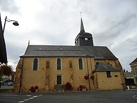 The church of Saint-Etienne, in Moncé-en-Belin | |
 Coat of arms | |
show Location of Moncé-en-Belin | |
 Moncé-en-Belin | |
| Coordinates: 47°53′43″N 0°11′56″E / 47.8953°N 0.1989°ECoordinates: 47°53′43″N 0°11′56″E / 47.8953°N 0.1989°E | |
| Country | France |
| Region | Pays de la Loire |
| Department | Sarthe |
| Arrondissement | Le Mans |
| Canton | Écommoy |
| Intercommunality | CC de l'Orée de Bercé Bélinois |
| Government | |
| • Mayor (2020–2026) | Irène Boyer[1] |
| Area 1 | 17.49 km2 (6.75 sq mi) |
| Population (Jan. 2018)[2] | 3,738 |
| • Density | 210/km2 (550/sq mi) |
| Demonym(s) | Moncéen, Moncéenne |
| Time zone | UTC+01:00 (CET) |
| • Summer (DST) | UTC+02:00 (CEST) |
| INSEE/Postal code | 72220 /72230 |
| Elevation | 40–81 m (131–266 ft) |
| 1 French Land Register data, which excludes lakes, ponds, glaciers > 1 km2 (0.386 sq mi or 247 acres) and river estuaries. | |


Moncé-en-Belin is a commune in the Sarthe department in the region of Pays de la Loire in north-western France.
See also[]
- Communes of the Sarthe department
References[]
- ^ "Répertoire national des élus: les maires". data.gouv.fr, Plateforme ouverte des données publiques françaises (in French). 2 December 2020.
- ^ "Populations légales 2018". INSEE. 28 December 2020.
| Wikimedia Commons has media related to Moncé-en-Belin. |
| show Communes of the Sarthe department |
|---|
| show Authority control |
|---|
This Sarthe geographical article is a stub. You can help Wikipedia by . |
Categories:
- Communes of Sarthe
- Sarthe geography stubs