Changé, Sarthe
Changé | |
|---|---|
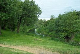 The Auneau creek through the town center | |
show Location of Changé | |
 Changé | |
| Coordinates: 47°59′19″N 0°16′59″E / 47.9886°N 0.2831°ECoordinates: 47°59′19″N 0°16′59″E / 47.9886°N 0.2831°E | |
| Country | France |
| Region | Pays de la Loire |
| Department | Sarthe |
| Arrondissement | Le Mans |
| Canton | Changé |
| Intercommunality | Sud-Est du Pays Manceau |
| Government | |
| • Mayor (2020–2026) | Yves-Marie Hervé |
| Area 1 | 35.06 km2 (13.54 sq mi) |
| Population (Jan. 2018)[1] | 6,549 |
| • Density | 190/km2 (480/sq mi) |
| Demonym(s) | Changéen, Changéenne |
| Time zone | UTC+01:00 (CET) |
| • Summer (DST) | UTC+02:00 (CEST) |
| INSEE/Postal code | 72058 /72560 |
| Elevation | 49–127 m (161–417 ft) |
| 1 French Land Register data, which excludes lakes, ponds, glaciers > 1 km2 (0.386 sq mi or 247 acres) and river estuaries. | |


Changé (French pronunciation: [ʃɑ̃ʒe]) is a commune in the Sarthe department in the region of Pays de la Loire in north-western France.
See also[]
- Communes of the Sarthe department
References[]
- ^ "Populations légales 2018". INSEE. 28 December 2020.
| Wikimedia Commons has media related to Changé (Sarthe). |
| show Communes of the Sarthe department |
|---|
This Sarthe geographical article is a stub. You can help Wikipedia by . |
Categories:
- Communes of Sarthe
- Sarthe geography stubs