Bayfield, Colorado
Bayfield, Colorado | |
|---|---|
Statutory Town[1] | |
| Town of Bayfield[1] | |
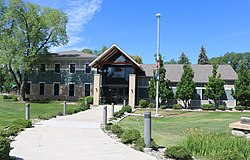 Bayfield Town Hall | |
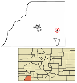 Location of the Town of Bayfield in La Plata County, Colorado. | |
 Bayfield Location of the Town of Bayfield in the United States. | |
| Coordinates: 37°14′07″N 107°35′41″W / 37.235248°N 107.594814°WCoordinates: 37°14′07″N 107°35′41″W / 37.235248°N 107.594814°W[6] | |
| Country | |
| State | |
| County | La Plata[1] |
| Incorporated (town) | August 18, 1906[4] |
| Government | |
| • Type | Statutory Town[1] |
| • Mayor | Ashleigh Tarkington[2] |
| • Town Manager | Katie Sickles[3] |
| Area | |
| • Total | 1.646 sq mi (4.264 km2) |
| • Land | 1.646 sq mi (4.264 km2) |
| • Water | 0.000 sq mi (0.000 km2) |
| Elevation | 6,900 ft (2,103 m) |
| Population | |
| • Total | 2,838 |
| • Density | 1,724/sq mi (666/km2) |
| • Metro | 55,638 |
| Time zone | UTC−07:00 (MST) |
| • Summer (DST) | UTC−06:00 (MDT) |
| ZIP code | 81122[8] |
| Area code(s) | 9708849544 |
| FIPS code | 08-05265 |
| GNIS feature ID | 0184411 |
| Website | www |

The Town of Bayfield is a Statutory Town located in La Plata County, Colorado, United States.[1] The town population was 2,838 at the 2020 United States Census, a +21.65% increase since the 2010 United States Census.[5] Bayfield is part of the Durango, CO Micropolitan Statistical Area.
History[]
The town derives its name from W.A. Bay, founder.[9]
Geography[]
Bayfield is located at 37°13′50″N 107°35′58″W / 37.23056°N 107.59944°W (37.230532, -107.599539),[10] along U.S. Highway 160.
At the 2020 United States Census, the town had a total area of 1,054 acres (4.264 km2), all of it land.[5]

Demographics[]
| Historical population | |||
|---|---|---|---|
| Census | Pop. | %± | |
| 1910 | 227 | — | |
| 1920 | 267 | 17.6% | |
| 1930 | 277 | 3.7% | |
| 1940 | 372 | 34.3% | |
| 1950 | 335 | −9.9% | |
| 1960 | 32 | −90.4% | |
| 1970 | 320 | 900.0% | |
| 1980 | 724 | 126.3% | |
| 1990 | 1,090 | 50.6% | |
| 2000 | 1,549 | 42.1% | |
| 2010 | 2,333 | 50.6% | |
| 2020 | 2,838 | 21.6% | |
| U.S. Decennial Census | |||
As of the census[11] of 2000, there were 1,549 people, 567 households, and 409 families residing in the town. The population density was 1,433.3 people per square mile (553.8/km2). There were 597 housing units at an average density of 552.4 per square mile (213.4/km2). The racial makeup of the town was 91.67% White, 0.19% African American, 2.13% Native American, 0.13% Asian, 3.36% from other races, and 2.52% from two or more races. Hispanic or Latino of any race were 10.46% of the population.
There were 567 households, out of which 43.2% had children under the age of 18 living with them, 59.3% were married couples living together, 8.6% had a female householder with no husband present, and 27.7% were non-families. 22.8% of all households were made up of individuals, and 6.0% had someone living alone who was 65 years of age or older. The average household size was 2.71 and the average family size was 3.19.
In the town, the population was spread out, with 31.2% under the age of 18, 7.4% from 18 to 24, 30.0% from 25 to 44, 23.8% from 45 to 64, and 7.5% who were 65 years of age or older. The median age was 35 years. For every 100 females, there were 98.3 males. For every 100 females age 18 and over, there were 92.9 males.
The median income for a household in the town was $39,336, and the median income for a family was $46,583. Males had a median income of $34,464 versus $22,027 for females. The per capita income for the town was $17,324. About 2.9% of families and 5.6% of the population were below the poverty line, including 3.8% of those under age 18 and 7.9% of those age 65 or over.
See also[]
- Colorado
- Bibliography of Colorado
- Index of Colorado-related articles
- Outline of Colorado
- List of places in Colorado
- Colorado metropolitan areas
- Durango, CO Micropolitan Statistical Area
- Spring Creek Archeological District, a Basketmaker and Pueblo site near Bayfield
References[]
- ^ Jump up to: a b c d e "Active Colorado Municipalities". State of Colorado, Department of Local Affairs. Archived from the original on 2009-12-12. Retrieved 2007-09-01.
- ^ "Town Mayor and Trustees". Town of Bayfield. Archived from the original on November 1, 2006. Retrieved 2007-08-20.
- ^ "Administration". Town of Bayfield. Archived from the original on 2007-08-24. Retrieved 2007-08-20.
- ^ "Colorado Municipal Incorporations". State of Colorado, Department of Personnel & Administration, Colorado State Archives. 2004-12-01. Archived from the original on 27 September 2007. Retrieved 2007-08-18.
- ^ Jump up to: a b c d "Decennial Census P.L. 94-171 Redistricting Data". United States Census Bureau, United States Department of Commerce. August 12, 2021. Retrieved September 7, 2021.
- ^ "2014 U.S. Gazetteer Files: Places". United States Census Bureau. July 1, 2014. Retrieved January 5, 2015.
- ^ "US Board on Geographic Names". United States Geological Survey. 2007-10-25. Retrieved 2008-01-31.
- ^ "ZIP Code Lookup". United States Postal Service. August 20, 2007. Archived from the original (JavaScript/HTML) on 21 August 2007. Retrieved August 20, 2007.
- ^ Dawson, John Frank (1954). Place names in Colorado: why 700 communities were so named, 150 of Spanish or Indian origin. Denver, CO: The J. Frank Dawson Publishing Co. p. 9.[permanent dead link]
- ^ "US Gazetteer files: 2010, 2000, and 1990". United States Census Bureau. 2011-02-12. Retrieved 2011-04-23.
- ^ "U.S. Census website". United States Census Bureau. Retrieved 2008-01-31.
External links[]
| Wikimedia Commons has media related to Bayfield, Colorado |
| show Municipalities and communities of La Plata County, Colorado, United States |
|---|


| show Authority control |
|---|
- Towns in La Plata County, Colorado
- Towns in Colorado