Broye-Aubigney-Montseugny
Broye-Aubigney-Montseugny | |
|---|---|
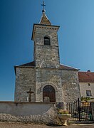
 The church in Aubigney | |
 Coat of arms | |
show Location of Broye-Aubigney-Montseugny | |
 Broye-Aubigney-Montseugny | |
| Coordinates: 47°18′53″N 5°30′35″E / 47.3147°N 5.5097°ECoordinates: 47°18′53″N 5°30′35″E / 47.3147°N 5.5097°E | |
| Country | France |
| Region | Bourgogne-Franche-Comté |
| Department | Haute-Saône |
| Arrondissement | Vesoul |
| Canton | Marnay |
| Intercommunality | Val de Gray |
| Government | |
| • Mayor (2020–2026) | Jean-François Cercley[1] |
| Area 1 | 25.36 km2 (9.79 sq mi) |
| Population (Jan. 2018)[2] | 492 |
| • Density | 19/km2 (50/sq mi) |
| Time zone | UTC+01:00 (CET) |
| • Summer (DST) | UTC+02:00 (CEST) |
| INSEE/Postal code | 70101 /70140 |
| Elevation | 183–242 m (600–794 ft) (avg. 180 m or 590 ft) |
| 1 French Land Register data, which excludes lakes, ponds, glaciers > 1 km2 (0.386 sq mi or 247 acres) and river estuaries. | |


Broye-Aubigney-Montseugny (French pronunciation: [bʁwa obiɲɛ mɔ̃søɲi]) is a commune in the Haute-Saône department in the region of Bourgogne-Franche-Comté in eastern France.
The town was formed by the merger of Broye-lès-Pesmes, Aubigney, and Montseugny in 1972.
Broye-lès-Pesmes was a major settlement of the Sequani tribe in the pre-Roman and Roman era, known as Magetobria or Admagetobria. Up to the 19th century, the town was called Moigte-de-Broie, which was derived from its ancient name.
Gallery[]

Aubigney's lavoir
Montseugny's church

Montseugny's church tympanum


See also[]
References[]
- ^ "Répertoire national des élus: les maires". data.gouv.fr, Plateforme ouverte des données publiques françaises (in French). 2 December 2020. Retrieved 7 December 2020.
- ^ "Populations légales 2018". INSEE. 28 December 2020.
| Wikimedia Commons has media related to Broye-Aubigney-Montseugny. |
| show Authority control |
|---|
This Haute-Saône geographical article is a stub. You can help Wikipedia by . |
Categories:
- Communes of Haute-Saône
- Sequani
- Haute-Saône geography stubs