Cliousclat
Cliousclat | |
|---|---|
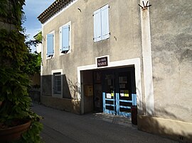 The town hall in Cliousclat | |
show Location of Cliousclat | |
 Cliousclat | |
| Coordinates: 44°43′00″N 4°50′12″E / 44.7167°N 4.8367°ECoordinates: 44°43′00″N 4°50′12″E / 44.7167°N 4.8367°E | |
| Country | France |
| Region | Auvergne-Rhône-Alpes |
| Department | Drôme |
| Arrondissement | Die |
| Canton | Loriol-sur-Drôme |
| Intercommunality | Val de Drôme en Biovallée |
| Government | |
| • Mayor (2008–2014) | Sylvette Course |
| Area 1 | 9.65 km2 (3.73 sq mi) |
| Population (Jan. 2018)[1] | 627 |
| • Density | 65/km2 (170/sq mi) |
| Time zone | UTC+01:00 (CET) |
| • Summer (DST) | UTC+02:00 (CEST) |
| INSEE/Postal code | 26097 /26270 |
| Elevation | 125–473 m (410–1,552 ft) (avg. 213 m or 699 ft) |
| 1 French Land Register data, which excludes lakes, ponds, glaciers > 1 km2 (0.386 sq mi or 247 acres) and river estuaries. | |


Cliousclat is a commune in the Drôme department in southeastern France.
Population[]
| Year | Pop. | ±% |
|---|---|---|
| 1911 | 485 | — |
| 1962 | 340 | −29.9% |
| 1968 | 344 | +1.2% |
| 1975 | 356 | +3.5% |
| 1982 | 413 | +16.0% |
| 1990 | 558 | +35.1% |
| 1999 | 644 | +15.4% |
| 2008 | 617 | −4.2% |
See also[]
References[]
- ^ "Populations légales 2018". INSEE. 28 December 2020.
| Wikimedia Commons has media related to Cliousclat. |
This Drôme geographical article is a stub. You can help Wikipedia by . |
Categories:
- Communes of Drôme
- Drôme geography stubs