Fay-le-Clos
Fay-le-Clos | |
|---|---|
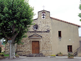 The church of the village | |
show Location of Fay-le-Clos | |
 Fay-le-Clos | |
| Coordinates: 45°12′51″N 4°54′24″E / 45.2142°N 4.9067°ECoordinates: 45°12′51″N 4°54′24″E / 45.2142°N 4.9067°E | |
| Country | France |
| Region | Auvergne-Rhône-Alpes |
| Department | Drôme |
| Arrondissement | Valence |
| Canton | Saint-Vallier |
| Intercommunality | Porte de Dromardèche |
| Government | |
| • Mayor (2008–2014) | Jean-Gilles Berruyer |
| Area 1 | 4.56 km2 (1.76 sq mi) |
| Population (Jan. 2018)[1] | 160 |
| • Density | 35/km2 (91/sq mi) |
| Time zone | UTC+01:00 (CET) |
| • Summer (DST) | UTC+02:00 (CEST) |
| INSEE/Postal code | 26133 /26240 |
| Elevation | 231–373 m (758–1,224 ft) (avg. 224 m or 735 ft) |
| 1 French Land Register data, which excludes lakes, ponds, glaciers > 1 km2 (0.386 sq mi or 247 acres) and river estuaries. | |


Fay-le-Clos is a commune in the Drôme department in the Auvergne-Rhône-Alpes region in southeastern France.
Population[]
| Year | Pop. | ±% |
|---|---|---|
| 1911 | 258 | — |
| 1962 | 133 | −48.4% |
| 1968 | 159 | +19.5% |
| 1975 | 143 | −10.1% |
| 1982 | 144 | +0.7% |
| 1990 | 151 | +4.9% |
| 1999 | 169 | +11.9% |
| 2008 | 153 | −9.5% |
See also[]
References[]
- ^ "Populations légales 2018". INSEE. 28 December 2020.
| Wikimedia Commons has media related to Fay-le-Clos. |
This Drôme geographical article is a stub. You can help Wikipedia by . |
Categories:
- Communes of Drôme
- Drôme geography stubs