Larnage
Larnage | |
|---|---|
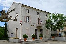 Town hall | |
show Location of Larnage | |
 Larnage | |
| Coordinates: 45°05′52″N 4°51′52″E / 45.0978°N 4.8644°ECoordinates: 45°05′52″N 4°51′52″E / 45.0978°N 4.8644°E | |
| Country | France |
| Region | Auvergne-Rhône-Alpes |
| Department | Drôme |
| Arrondissement | Valence |
| Canton | Tain-l'Hermitage |
| Government | |
| • Mayor (2020–2026) | Gérard Roberton |
| Area 1 | 9.08 km2 (3.51 sq mi) |
| Population (Jan. 2018)[1] | 1,067 |
| • Density | 120/km2 (300/sq mi) |
| Time zone | UTC+01:00 (CET) |
| • Summer (DST) | UTC+02:00 (CEST) |
| INSEE/Postal code | 26156 /26600 |
| Elevation | 135–360 m (443–1,181 ft) (avg. 247 m or 810 ft) |
| 1 French Land Register data, which excludes lakes, ponds, glaciers > 1 km2 (0.386 sq mi or 247 acres) and river estuaries. | |


Larnage (French pronunciation: [laʁnaʒ]) is a commune in the Drôme department in southeastern France.
Population[]
| Year | Pop. | ±% |
|---|---|---|
| 1911 | 670 | — |
| 1962 | 514 | −23.3% |
| 1968 | 526 | +2.3% |
| 1975 | 566 | +7.6% |
| 1982 | 631 | +11.5% |
| 1990 | 663 | +5.1% |
| 1999 | 770 | +16.1% |
| 2008 | 986 | +28.1% |
See also[]
References[]
- ^ "Populations légales 2018". INSEE. 28 December 2020.
| Wikimedia Commons has media related to Larnage. |
This Drôme geographical article is a stub. You can help Wikipedia by . |
Categories:
- Communes of Drôme
- Drôme geography stubs