Ratières
Ratières | |
|---|---|
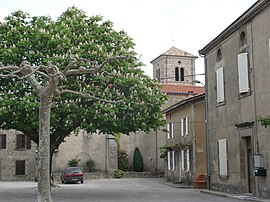 A view within the village of Ratières | |
show Location of Ratières | |
 Ratières | |
| Coordinates: 45°10′57″N 4°58′08″E / 45.1825°N 4.9689°ECoordinates: 45°10′57″N 4°58′08″E / 45.1825°N 4.9689°E | |
| Country | France |
| Region | Auvergne-Rhône-Alpes |
| Department | Drôme |
| Arrondissement | Valence |
| Canton | Drôme des collines |
| Intercommunality | Porte de DrômArdèche |
| Government | |
| • Mayor (2020–2026) | David Bouvier[1] |
| Area 1 | 9.01 km2 (3.48 sq mi) |
| Population (Jan. 2018)[2] | 268 |
| • Density | 30/km2 (77/sq mi) |
| Time zone | UTC+01:00 (CET) |
| • Summer (DST) | UTC+02:00 (CEST) |
| INSEE/Postal code | 26259 /26330 |
| Elevation | 232–449 m (761–1,473 ft) |
| 1 French Land Register data, which excludes lakes, ponds, glaciers > 1 km2 (0.386 sq mi or 247 acres) and river estuaries. | |


Ratières (French pronunciation: [ʁatjɛʁ]) is a commune in the Drôme department in southeastern France.
Population[]
| Year | Pop. | ±% |
|---|---|---|
| 1911 | 314 | — |
| 1962 | 217 | −30.9% |
| 1968 | 222 | +2.3% |
| 1975 | 191 | −14.0% |
| 1982 | 182 | −4.7% |
| 1990 | 206 | +13.2% |
| 1999 | 255 | +23.8% |
| 2008 | 274 | +7.5% |
Sights[]

Tour de Ratières
- The Tour de Ratières is the 14th keep of a castle. Extensive modern gardens designed by Paolo Tonini are in the grounds.
See also[]
References[]
- ^ "Répertoire national des élus: les maires". data.gouv.fr, Plateforme ouverte des données publiques françaises (in French). 2 December 2020.
- ^ "Populations légales 2018". INSEE. 28 December 2020.
| Wikimedia Commons has media related to Ratières. |
This Drôme geographical article is a stub. You can help Wikipedia by . |
Categories:
- Communes of Drôme
- Drôme geography stubs