Réauville
Réauville | |
|---|---|
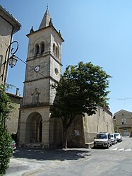 The church in Réauville | |
show Location of Réauville | |
 Réauville | |
| Coordinates: 44°26′43″N 4°50′42″E / 44.4453°N 4.845°ECoordinates: 44°26′43″N 4°50′42″E / 44.4453°N 4.845°E | |
| Country | France |
| Region | Auvergne-Rhône-Alpes |
| Department | Drôme |
| Arrondissement | Nyons |
| Canton | Grignan |
| Government | |
| • Mayor (2020–2026) | Norbert Perrin |
| Area 1 | 18.22 km2 (7.03 sq mi) |
| Population (Jan. 2018)[1] | 393 |
| • Density | 22/km2 (56/sq mi) |
| Time zone | UTC+01:00 (CET) |
| • Summer (DST) | UTC+02:00 (CEST) |
| INSEE/Postal code | 26261 /26230 |
| Elevation | 117–372 m (384–1,220 ft) (avg. 243 m or 797 ft) |
| 1 French Land Register data, which excludes lakes, ponds, glaciers > 1 km2 (0.386 sq mi or 247 acres) and river estuaries. | |


Réauville (French pronunciation: [ʁeovil]; Occitan: Reauvila) is a commune in the Drôme department in southeastern France.
Population[]
| Year | Pop. | ±% |
|---|---|---|
| 1911 | 502 | — |
| 1962 | 189 | −62.4% |
| 1968 | 167 | −11.6% |
| 1975 | 166 | −0.6% |
| 1982 | 243 | +46.4% |
| 1990 | 315 | +29.6% |
| 1999 | 336 | +6.7% |
| 2008 | 376 | +11.9% |
See also[]
- Aiguebelle Abbey
- Communes of the Drôme department
References[]
- ^ "Populations légales 2018". INSEE. 28 December 2020.
| Wikimedia Commons has media related to Réauville. |
This Drôme geographical article is a stub. You can help Wikipedia by . |
Categories:
- Communes of Drôme
- Drôme geography stubs