Coral Hills, Maryland
Coral Hills, Maryland | |
|---|---|
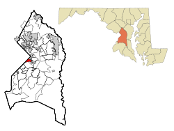 Location of Coral Hills, Maryland | |
| Coordinates: 38°52′20″N 76°55′41″W / 38.87222°N 76.92806°WCoordinates: 38°52′20″N 76°55′41″W / 38.87222°N 76.92806°W | |
| Country | |
| State | |
| County | |
| Area | |
| • Total | 1.5 sq mi (3.9 km2) |
| • Land | 1.5 sq mi (3.9 km2) |
| • Water | 0.0 sq mi (0.0 km2) |
| Elevation | 292 ft (89 m) |
| Population (2010) | |
| • Total | 9,895 |
| • Density | 6,600/sq mi (2,500/km2) |
| Time zone | UTC−5 (Eastern (EST)) |
| • Summer (DST) | UTC−4 (EDT) |
| FIPS code | 24-19825 |
| GNIS feature ID | 0597280 |

Coral Hills is an unincorporated area and census-designated place (CDP) in Prince George's County, Maryland, United States.[1] As of the 2010 census, the CDP population was 9,895.[2]
Geography[]
Coral Hills is located at 38°52′20″N 76°55′41″W / 38.87222°N 76.92806°W (38.872312, −76.928010).[3]
According to the United States Census Bureau, the CDP has a total area of 1.5 square miles (3.9 km2), all land.
Demographics[]
As of the census[4] of 2000, there were 10,720 people, 3,833 households, and 2,694 families residing in the CDP. The population density was 7,046.6 people per square mile (2,723.0/km2). There were 4,177 housing units at an average density of 2,745.7/sq mi (1,061.0/km2). The racial makeup of the CDP was 3.59% White, 93.56% African American, 0.49% Native American, 0.51% Asian, 0.05% Pacific Islander, 0.45% from other races, and 1.34% from two or more races. Hispanic or Latino of any race were 1.25% of the population.
There were 3,833 households, out of which 35.2% had children under the age of 18 living with them, 31.3% were married couples living together, 30.9% had a female householder with no husband present, and 29.7% were non-families. 23.9% of all households were made up of individuals, and 3.3% had someone living alone who was 65 years of age or older. The average household size was 2.80 and the average family size was 3.31.
In the CDP, the population was spread out, with 30.7% under the age of 18, 9.8% from 18 to 24, 31.1% from 25 to 44, 21.9% from 45 to 64, and 6.5% who were 65 years of age or older. The median age was 32 years. For every 100 females, there were 88.2 males. For every 100 females age 18 and over, there were 84.0 males.
The median income for a household in the CDP was $41,122, and the median income for a family was $45,288. Males had a median income of $30,799 versus $30,466 for females. The per capita income for the CDP was $17,876. About 9.2% of families and 12.1% of the population were below the poverty line, including 13.3% of those under age 18 and 11.8% of those age 65 or over.
Education[]
Coral Hills is a part of the Prince George's County Public Schools system.[5]
Zoned elementary schools for the CDP are Bradbury Heights, Doswell Brooks, Concord, and William Hall.[6] Zoned middle schools for the CDP are Drew-Freeman, William Hall, and Walker Mill.[7] All residents are zoned to Suitland High School.[8] William Hall was previously an elementary school but was scheduled to convert into being a K-8 in 2009.[9]
John Edgar Howard Elementary was previously in Coral Hills CDP.[10] It was scheduled to close in 2009.[11] The facility is now used as the John E. Howard Community Center.[12]
Parks and recreation[]
The Prince George's County Department of Parks and Recreation operates the John E. Howard Community Center,[12] the former John E. Howard Elementary School.[10] It includes an athletic field, a game room, a gymnasium, a playground, and a tennis court. It also has a kitchen, a multipurpose area, and a picnic facility with tables.[12]
References[]
- ^ U.S. Geological Survey Geographic Names Information System: Coral Hills, Maryland
- ^ "Profile of General Population and Housing Characteristics: 2010 Demographic Profile Data (DP-1): Coral Hills CDP, Maryland". United States Census Bureau. Retrieved December 19, 2011.
- ^ "US Gazetteer files: 2010, 2000, and 1990". United States Census Bureau. 2011-02-12. Retrieved 2011-04-23.
- ^ "U.S. Census website". United States Census Bureau. Retrieved 2008-01-31.
- ^ "2010 CENSUS - CENSUS BLOCK MAP: Coral Hills CDP, MD." U.S. Census Bureau. Retrieved on August 31, 2018.
- ^ "NEIGHBORHOOD ELEMENTARY SCHOOLS AND BOUNDARIES SCHOOL YEAR 2018-2019." Prince George's County Public Schools. Retrieved on August 31, 2018. The Concord zone is highlighted at the "Boundary" tab at .
- ^ "NEIGHBORHOOD MIDDLE SCHOOLS AND BOUNDARIES SCHOOL YEAR 2018-2019." Prince George's County Public Schools. Retrieved on August 31, 2018.
- ^ "NEIGHBORHOOD HIGH SCHOOLS AND BOUNDARIES SCHOOL YEAR 2018-2019." Prince George's County Public Schools. Retrieved on August 31, 2018.
- ^ Preliminary Subregion 4 Master Plan and Proposed Sectional Map Amendment. Maryland-National Capital Park and Planning Commission. Chapter 9, Public Facilities. p. 268 (PDF p. 10/28). Retrieved on September 7, 2018.
- ^ a b Home. John Edgar Howard Elementary School. February 19, 1999. Retrieved on September 7, 2018. "John Edgar Howard Elmentary [sic] School 4400 Shell Street Capitol Heights, MD 20743"
- ^ Preliminary Subregion 4 Master Plan and Proposed Sectional Map Amendment. Maryland-National Capital Park and Planning Commission. Chapter 9, Public Facilities. p. 261 (PDF p. 3/28). Retrieved on September 7, 2018.
- ^ a b c "John E Howard Community Center". Prince George's County Department of Parks and Recreation. Retrieved 2018-09-07.
John E Howard Community Center 4400 Shell Street Capitol Heights, MD 20743

- Census-designated places in Prince George's County, Maryland
- Census-designated places in Maryland
- Suburbs of Washington, D.C.