Rosaryville, Maryland
Rosaryville, Maryland | |
|---|---|
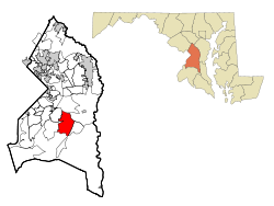 Location of Rosaryville, Maryland | |
| Coordinates: 38°46′4″N 76°50′8″W / 38.76778°N 76.83556°WCoordinates: 38°46′4″N 76°50′8″W / 38.76778°N 76.83556°W | |
| Country | |
| State | |
| County | |
| Area | |
| • Total | 9.2 sq mi (23.8 km2) |
| • Land | 9.2 sq mi (23.8 km2) |
| • Water | 0.0 sq mi (0.0 km2) |
| Elevation | 223 ft (68 m) |
| Population (2010) | |
| • Total | 10,697 |
| • Density | 1,200/sq mi (450/km2) |
| Time zone | UTC−5 (Eastern (EST)) |
| • Summer (DST) | UTC−4 (EDT) |
| Area code(s) | 301, 240 |
| FIPS code | 24-68300 |
| GNIS feature ID | 0597990 |

Rosaryville is an unincorporated area and census-designated place (CDP) in Prince George's County, Maryland, United States, located beside U.S. Route 301.[1] The population was 10,697 at the 2010 census,[2] including housing developments and rural open space. It was named for a local Roman Catholic church.[3] Close to Rosaryville are the Marlton housing development, Maryland Veterans Cemetery, the Southern Maryland Farmers Market, and Rosaryville State Park.
History[]
His Lordship's Kindness was listed on the National Register of Historic Places and as a National Historic Landmark in 1970.[4]
Geography[]
Rosaryville is located at 38°46′4″N 76°50′8″W / 38.76778°N 76.83556°W (38.767664, −76.835568).[5]
According to the United States Census Bureau, the CDP has a total area of 9.2 square miles (23.8 km2), of which 0.02 square miles (0.04 km2), or 0.18%, is water.[6]
Demographics[]
| Historical population | |||
|---|---|---|---|
| Census | Pop. | %± | |
| 1990 | 8,976 | — | |
| 2000 | 12,322 | 37.3% | |
| 2010 | 10,697 | −13.2% | |
| source:[2][7] | |||
As of the census[8] of 2000, there were 12,322 people, 4,112 households, and 3,367 families residing in the CDP. The population density was 901.4 people per square mile (348.0/km2). There were 4,267 housing units at an average density of 312.2/sq mi (120.5/km2). The racial makeup of the CDP was 34.13% White, 59.57% African American, 0.64% Native American, 2.67% Asian, 0.11% Pacific Islander, 0.63% from other races, and 2.25% from two or more races. Hispanic or Latino of any race were 2.12% of the population.
There were 4,112 households, out of which 40.5% had children under the age of 18 living with them, 64.7% were married couples living together, 12.6% had a female householder with no husband present, and 18.1% were non-families. 14.3% of all households were made up of individuals, and 3.6% had someone living alone who was 65 years of age or older. The average household size was 2.99 and the average family size was 3.29.
In the CDP, the population was spread out, with 28.0% under the age of 18, 6.8% from 18 to 24, 32.3% from 25 to 44, 25.8% from 45 to 64, and 7.1% who were 65 years of age or older. The median age was 37 years. For every 100 females, there were 95.4 males. For every 100 females age 18 and over, there were 92.4 males.
The median income for a household in the CDP was $79,715, and the median income for a family was $85,225. Males had a median income of $48,776 versus $41,843 for females. The per capita income for the CDP was $27,817. About 1.7% of families and 2.9% of the population were below the poverty line, including 3.3% of those under age 18 and none of those age 65 or over.
Government[]
Prince George's County Police Department District 5 Station in Clinton CDP serves the community.[9]
Education[]
Rosaryville residents are assigned to schools in Prince George's County Public Schools:[10]
Elementary schools serving sections of the 2010 CDP include Melwood Elementary School and Rosaryville Elementary School.[11]
Most residents are zoned to James Madison Middle School, with some zoned to Gwynn Park Middle School.[12]
Dr. Henry A. Wise Jr. High School and Frederick Douglass High School serve sections of the CDP.[13]
References[]
- ^ U.S. Geological Survey Geographic Names Information System: Rosaryville, Maryland
- ^ a b "Profile of General Population and Housing Characteristics: 2010 Demographic Profile Data (DP-1): Rosaryville CDP, Maryland". United States Census Bureau. Retrieved December 23, 2011.
- ^ "Our Parish History". St. Mary of the Assumption Church. Retrieved 2017-11-03.
- ^ "National Register Information System". National Register of Historic Places. National Park Service. July 9, 2010.
- ^ "US Gazetteer files: 2010, 2000, and 1990". United States Census Bureau. 2011-02-12. Retrieved 2011-04-23.
- ^ "Geographic Identifiers: 2010 Demographic Profile Data (G001): Rosaryville CDP, Maryland". United States Census Bureau. Retrieved December 23, 2011.
- ^ "CENSUS OF POPULATION AND HOUSING (1790-2000)". U.S. Census Bureau. Retrieved 2010-07-18.
- ^ "U.S. Census website". United States Census Bureau. Retrieved 2008-01-31.
- ^ "District 5 Station - Clinton." Prince George's County Police Department. Retrieved on September 9, 2018. " 6707 Groveton Drive Clinton, MD 20735". Beat map. See 2010 U.S. Census index map of Clinton CDP: area with police station is on the edge of page 6 with surroundings on page 5.
- ^ "2010 CENSUS - CENSUS BLOCK MAP: Rosaryville CDP, MD." U.S. Census Bureau. Retrieved on September 2, 2018. The CDP previously had a different shape: "CENSUS 2000 BLOCK MAP: ROSARYVILLE CDP" with pages 1 and 2. The 1990 U.S. Census Bureau map for Prince George's County (index map) shows Rosaryville CDP on pages 23, 29, 30, and 35.
- ^ "NEIGHBORHOOD ELEMENTARY SCHOOLS AND BOUNDARIES SCHOOL YEAR 2018-2019." Prince George's County Public Schools. Retrieved on September 2, 2018.
- ^ "NEIGHBORHOOD MIDDLE SCHOOLS AND BOUNDARIES SCHOOL YEAR 2018-2019." Prince George's County Public Schools. Retrieved on September 2, 2018.
- ^ "NEIGHBORHOOD HIGH SCHOOLS AND BOUNDARIES SCHOOL YEAR 2018-2019." Prince George's County Public Schools. Retrieved on September 2, 2018.
| Wikimedia Commons has media related to Rosaryville, Maryland. |

- Census-designated places in Prince George's County, Maryland
- Census-designated places in Maryland
- Washington metropolitan area