Kettering, Maryland
Kettering, Maryland | |
|---|---|
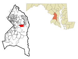 Location of Kettering, Maryland | |
| Coordinates: 38°53′42″N 76°47′47″W / 38.89500°N 76.79639°WCoordinates: 38°53′42″N 76°47′47″W / 38.89500°N 76.79639°W | |
| Country | |
| State | |
| County | |
| Area | |
| • Total | 5.5 sq mi (14.1 km2) |
| • Land | 5.5 sq mi (14.1 km2) |
| • Water | 0.0 sq mi (0.0 km2) |
| Elevation | 138 ft (42 m) |
| Population (2010) | |
| • Total | 12,790 |
| • Density | 2,300/sq mi (910/km2) |
| Time zone | UTC−5 (Eastern (EST)) |
| • Summer (DST) | UTC−4 (EDT) |
| ZIP codes | 20774-20775 |
| Area code(s) | 301, 240 |
| FIPS code | 24-43900 |
| GNIS feature ID | 1714445 |

Kettering is an unincorporated area and census-designated place in Prince George's County, Maryland, United States.[1] At the 2010 United States Census, the population was 12,790,[2] which is primarily African American. Kettering is adjacent to Prince George's Community College, the upscale gated community of Woodmore, Six Flags America, Evangel Temple megachurch, and the community of Largo at the end of the Washington Metro Blue Line. Watkins Regional Park in Kettering offers a large playground, a colorful carousel, miniature golf, a miniature train ride, and various animals.
Etymology[]
The name Kettering was created by a suburban housing developer in the 1960s when development began.
History[]
Kettering was majority white for much of its history. While majority white in the 1970 census, Kettering was 49% white by 1980 and only 17% white by 1990. The white population quickly declined as the community became majority African-American.[3]
Geography[]
Kettering is located at 38°53′42″N 76°47′47″W / 38.895012°N 76.796471°W.[4]
According to the United States Census Bureau, the CDP has a total area of 5.5 square miles (14 km2), all land.
Demographics[]
As of the census[5] of 2000, there were 11,008 people, 3,814 households, and 2,955 families residing in the CDP. The population density was 2,016.5 people per square mile (778.4/km2). There were 3,958 housing units at an average density of 725.0/sq mi (279.9/km2). The racial makeup of the CDP was 5.78% White, 90.62% African American, 0.19% Native American, 1.24% Asian, 0.47% from other races, and 1.71% from two or more races. Hispanic or Latino of any race were 0.95% of the population.
There were 3,814 households, out of which 36.3% had children under the age of 18 living with them, 50.0% were married couples living together, 23.3% had a female householder with no husband present, and 22.5% were non-families. 18.4% of all households were made up of individuals, and 1.7% had someone living alone who was 65 years of age or older. The average household size was 2.86 and the average family size was 3.24.
In the CDP, the population was spread out, with 26.6% under the age of 18, 7.1% from 18 to 24, 30.6% from 25 to 44, 29.1% from 45 to 64, and 6.6% who were 65 years of age or older. The median age was 37 years. For every 100 females, there were 81.3 males. For every 100 females age 18 and over, there were 75.8 males.
The median income for a household in the CDP was $78,735, and the median income for a family was $82,777. Males had a median income of $47,059 versus $45,243 for females. The per capita income for the CDP was $30,398. About 0.8% of families and 1.9% of the population were below the poverty line, including 1.9% of those under age 18 and 2.0% of those age 65 or over. By the end of 2020, the CDP ranks # 6 among top 10 richest black communities in US, with an average family income of $107,008.[6]
Government and infrastructure[]
Prince George's County Police Department District 2 Station in Brock Hall CDP, with a Bowie postal address, serves the community.[7]
The U.S. Postal Service operates the Kettering Post Office in Kettering CDP.[8][9]
Education[]
Kettering is a part of the Prince George's County Public Schools.[9]
Kettering, Perrywood, and Lake Arbor elementary schools serve sections of the Kettering CDP.[10] Almost all of the CDP is zoned to Kettering Middle School, with a portion zoned to Ernest Everett Just Middle School.[11] Most of the CDP is zoned to Largo High School while a portion is zoned to Dr. Henry A. Wise Jr. High School.[12]
Kettering is served by the Largo-Kettering Branch of the Prince George's County Memorial Library System in Largo.[13]
References[]
- ^ U.S. Geological Survey Geographic Names Information System: Kettering, Maryland
- ^ "Profile of General Population and Housing Characteristics: 2010 Demographic Profile Data (DP-1): Kettering CDP, Maryland". United States Census Bureau. Retrieved December 20, 2011.
- ^ "The Dispersion Decade". The Washington Times. Retrieved 2020-12-25.
- ^ "US Gazetteer files: 2010, 2000, and 1990". United States Census Bureau. 2011-02-12. Retrieved 2011-04-23.
- ^ "U.S. Census website". United States Census Bureau. Retrieved 2008-01-31.
- ^ "10 Richest Black Communities in America". Retrieved November 12, 2020.
- ^ "District 2 Station - Bowie." Prince George's County Police Department. Retrieved on September 9, 2018. "District 2 Station - Bowie 601 SW Crain Highway Bowie, MD 20715 ". Beat map. 2010 U.S. Census Bureau index map of Brock Hall CDP as well as the detail on Page 1.
- ^ "KETTERING." U.S. Postal Service. Retrieved on September 11, 2018. "68 WATKINS PARK DR UPPER MARLBORO, MD 20774-9996"
- ^ a b "2010 CENSUS - CENSUS BLOCK MAP (INDEX): Kettering CDP, MD." U.S. Census Bureau. Retrieved on August 28, 2018. Pages: 1 and 2.
- ^ "NEIGHBORHOOD ELEMENTARY SCHOOLS AND BOUNDARIES SCHOOL YEAR 2018-2019." Prince George's County Public Schools. Retrieved on August 28, 2018.
- ^ "NEIGHBORHOOD MIDDLE SCHOOLS AND BOUNDARIES SCHOOL YEAR 2018-2019." Prince George's County Public Schools. Retrieved on August 28, 2018.
- ^ "NEIGHBORHOOD HIGH SCHOOLS AND BOUNDARIES SCHOOL YEAR 2018-2019." Prince George's County Public Schools. Retrieved on August 28, 2018.
- ^ "Largo-Kettering Branch." Prince George's County Memorial Library System. Retrieved on August 29, 2018. "Largo-Kettering Branch 9601 Capital Lane Largo, MD 20774"
| Wikimedia Commons has media related to Kettering, Maryland. |

- African-American upper class
- Census-designated places in Prince George's County, Maryland
- Census-designated places in Maryland
- Washington metropolitan area