South Laurel, Maryland
South Laurel, Maryland | |
|---|---|
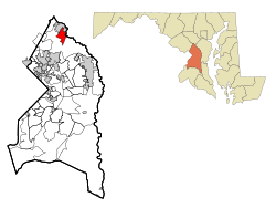 Location of South Laurel, Maryland | |
| Coordinates: 39°4′22″N 76°51′4″W / 39.07278°N 76.85111°WCoordinates: 39°4′22″N 76°51′4″W / 39.07278°N 76.85111°W | |
| Country | |
| State | |
| County | |
| Area | |
| • Total | 8.2 sq mi (21.2 km2) |
| • Land | 8.1 sq mi (21.1 km2) |
| • Water | 0.04 sq mi (0.1 km2) |
| Elevation | 161 ft (49 m) |
| Population (2010) | |
| • Total | 26,112 |
| • Density | 3,200/sq mi (1,200/km2) |
| Time zone | UTC−5 (Eastern (EST)) |
| • Summer (DST) | UTC−4 (EDT) |
| FIPS code | 24-73650 |
| GNIS feature ID | 1867303 |

South Laurel is an unincorporated area and census-designated place (CDP) in Prince George's County, Maryland, United States.[1] The population was 26,112 at the 2010 census.[2]
Geography[]
South Laurel is located at 39°4′22″N 76°51′4″W / 39.07278°N 76.85111°W (39.072741, −76.851007).[3]
According to the United States Census Bureau, the CDP has a total area of 8.2 square miles (21.2 km2), of which 8.2 square miles (21.2 km2) is land and 0.04 square miles (0.1 km2), or 0.42%, is water.[4]
Demographics[]
As of the census[5] of 2000, there were 20,479 people, 8,260 households, and 5,055 families residing in the CDP. The population density was 4,785.1 people per square mile (1,847.4/km2). There were 8,621 housing units at an average density of 2,014.4/sq mi (777.7/km2). The racial makeup of the CDP was 38.68% White, 49.70% African American, 0.19% Native American, 5.61% Asian, 0.03% Pacific Islander, 2.55% from other races, and 3.23% from two or more races. Hispanic or Latino of any race were 5.26% of the population.
There were 8,260 households, out of which 33.6% had children under the age of 18 living with them, 38.6% were married couples living together, 17.2% had a female householder with no husband present, and 38.8% were non-families. 30.0% of all households were made up of individuals, and 5.1% had someone living alone who was 65 years of age or older. The average household size was 2.45 and the average family size was 3.06.
In the CDP, the population was spread out, with 26.2% under the age of 18, 10.0% from 18 to 24, 38.4% from 25 to 44, 18.5% from 45 to 64, and 6.8% who were 65 years of age or older. The median age was 31 years. For every 100 females, there were 90.9 males. For every 100 females age 18 and over, there were 86.6 males.
The median income for a household in the CDP was $51,043, and the median income for a family was $60,028. Males had a median income of $38,559 versus $32,068 for females. The per capita income for the CDP was $24,564. About 3.5% of families and 5.9% of the population were below the poverty line, including 8.9% of those under age 18 and 3.0% of those age 65 or over.
Government and infrastructure[]
The U.S. Postal Service operates the Montpelier Post Office in South Laurel CDP.[6][7]
Education[]
Primary and secondary schools[]
South Laurel CDP is served by schools in the Prince George's County Public Schools.[6]
Zoned elementary schools serving sections of the CDP include: Deerfield Run, James Harrison, Laurel, Montpelier, Oaklands, and Vansville.[8]
Most residents are zoned to Dwight D. Eisenhower Middle School in South Laurel while some are zoned to Martin Luther King Middle School in Beltsville.[9] All residents are zoned to Laurel High School in Laurel.[10]
Colleges and universities[]
Capitol Technology University is in South Laurel,[6][11] on the site of the former Beltsville Speedway (a.k.a. Baltimore-Washington Speedway).[12]
References[]
- ^ U.S. Geological Survey Geographic Names Information System: South Laurel, Maryland
- ^ "Profile of General Population and Housing Characteristics: 2010 Demographic Profile Data (DP-1): South Laurel CDP, Maryland". United States Census Bureau. Retrieved December 23, 2011.
- ^ "US Gazetteer files: 2010, 2000, and 1990". United States Census Bureau. 2011-02-12. Retrieved 2011-04-23.
- ^ "Geographic Identifiers: 2010 Demographic Profile Data (DP-1): South Laurel CDP, Maryland". United States Census Bureau. Retrieved December 23, 2011.
- ^ "U.S. Census website". United States Census Bureau. Retrieved 2008-01-31.
- ^ a b c "2010 CENSUS - CENSUS BLOCK MAP (INDEX): South Laurel CDP, MD." U.S. Census Bureau. Retrieved on August 26, 2018. Pages: 1, 2, and 3. Note that the census-designated place was previously smaller: 2000 Index Map and pages 1 and 2. In the 1990 map of Prince George's County (see index), South Laurel is on pages 2 and 5.
- ^ "MONTPELIER." . Retrieved on September 11, 2018. "12625 LAUREL BOWIE RD LAUREL, MD 20708-9998"
- ^ "NEIGHBORHOOD ELEMENTARY SCHOOLS AND BOUNDARIES SCHOOL YEAR 2018-2019." Prince George's County Public Schools. Retrieved on August 26, 2018.
- ^ "NEIGHBORHOOD MIDDLE SCHOOLS AND BOUNDARIES SCHOOL YEAR 2018-2019." Prince George's County Public Schools. Retrieved on August 26, 2018.
- ^ "NEIGHBORHOOD HIGH SCHOOLS AND BOUNDARIES SCHOOL YEAR 2018-2019." Prince George's County Public Schools. Retrieved on August 26, 2018.
- ^ Campus map. Capitol Technology University. Retrieved on August 26, 2018. "Capitol Technology University 11301 Springfield Road Laurel, MD 20708"
- ^ "Capitol History." Capitol Technology University. Retrieved on August 26, 2018. "In 1980 the college found its home in Laurel, Maryland. Within three years, Capitol purchased the 52-acre former site of the Beltsville Speedway, [...]"
| Wikimedia Commons has media related to South Laurel, Maryland. |

- Census-designated places in Prince George's County, Maryland
- Census-designated places in Maryland