Corbenay
Corbenay | |
|---|---|
 The town hall and war memorial in Corbenay | |
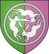
 Coat of arms | |
show Location of Corbenay | |
 Corbenay | |
| Coordinates: 47°53′30″N 6°19′33″E / 47.8917°N 6.3258°ECoordinates: 47°53′30″N 6°19′33″E / 47.8917°N 6.3258°E | |
| Country | France |
| Region | Bourgogne-Franche-Comté |
| Department | Haute-Saône |
| Arrondissement | Lure |
| Canton | Saint-Loup-sur-Semouse |
| Area 1 | 15.73 km2 (6.07 sq mi) |
| Population (Jan. 2018)[1] | 1,275 |
| • Density | 81/km2 (210/sq mi) |
| Time zone | UTC+01:00 (CET) |
| • Summer (DST) | UTC+02:00 (CEST) |
| INSEE/Postal code | 70171 /70320 |
| Elevation | 246–331 m (807–1,086 ft) |
| 1 French Land Register data, which excludes lakes, ponds, glaciers > 1 km2 (0.386 sq mi or 247 acres) and river estuaries. | |


Corbenay is a commune in the Haute-Saône department in the region of Bourgogne-Franche-Comté in eastern France.
The coat of arms of Corbenay features the heraldic "three hares" motif.
See also[]
References[]
| Wikimedia Commons has media related to Corbenay. |
- ^ "Populations légales 2018". INSEE. 28 December 2020.
This Haute-Saône geographical article is a stub. You can help Wikipedia by . |
Categories:
- Communes of Haute-Saône
- Haute-Saône geography stubs