Courpignac
show This article may be expanded with text translated from the corresponding article in French. (December 2008) Click [show] for important translation instructions. |
Courpignac | |
|---|---|
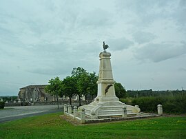 War memorial | |
show Location of Courpignac | |
 Courpignac | |
| Coordinates: 45°19′42″N 0°29′09″W / 45.3283°N 0.4858°WCoordinates: 45°19′42″N 0°29′09″W / 45.3283°N 0.4858°W | |
| Country | France |
| Region | Nouvelle-Aquitaine |
| Department | Charente-Maritime |
| Arrondissement | Jonzac |
| Canton | Pons |
| Government | |
| • Mayor (2008–2014) | Pierre Arthaud |
| Area 1 | 14.97 km2 (5.78 sq mi) |
| Population (Jan. 2018)[1] | 415 |
| • Density | 28/km2 (72/sq mi) |
| Time zone | UTC+01:00 (CET) |
| • Summer (DST) | UTC+02:00 (CEST) |
| INSEE/Postal code | 17139 /17130 |
| Elevation | 18–96 m (59–315 ft) |
| 1 French Land Register data, which excludes lakes, ponds, glaciers > 1 km2 (0.386 sq mi or 247 acres) and river estuaries. | |


Courpignac is a commune in the Charente-Maritime department in the Nouvelle-Aquitaine region in southwestern France.
Population[]
| Year | Pop. | ±% |
|---|---|---|
| 1962 | 355 | — |
| 1968 | 396 | +11.5% |
| 1975 | 347 | −12.4% |
| 1982 | 339 | −2.3% |
| 1990 | 341 | +0.6% |
| 1999 | 359 | +5.3% |
| 2008 | 407 | +13.4% |
See also[]
References[]
- ^ "Populations légales 2018". INSEE. 28 December 2020.
| Wikimedia Commons has media related to Courpignac. |
This Charente-Maritime geographical article is a stub. You can help Wikipedia by . |
Categories:
- Communes of Charente-Maritime
- Charente-Maritime geography stubs