Dolus-d'Oléron
Dolus-d'Oléron | |
|---|---|
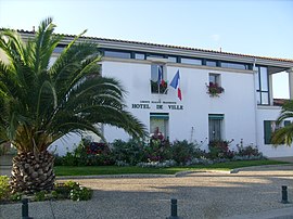 The town hall in Dolus-d'Oléron | |
 Coat of arms | |
show Location of Dolus-d'Oléron | |
 Dolus-d'Oléron | |
| Coordinates: 45°54′43″N 1°15′35″W / 45.9119°N 1.2597°WCoordinates: 45°54′43″N 1°15′35″W / 45.9119°N 1.2597°W | |
| Country | France |
| Region | Nouvelle-Aquitaine |
| Department | Charente-Maritime |
| Arrondissement | Rochefort |
| Canton | Île d'Oléron |
| Intercommunality | Île-d'Oléron |
| Government | |
| • Mayor (2008–2014) | Jean-Jacques Bazerbes |
| Area 1 | 29.02 km2 (11.20 sq mi) |
| Population (Jan. 2018)[1] | 3,187 |
| • Density | 110/km2 (280/sq mi) |
| Time zone | UTC+01:00 (CET) |
| • Summer (DST) | UTC+02:00 (CEST) |
| INSEE/Postal code | 17140 /17550 |
| Elevation | 0–20 m (0–66 ft) |
| 1 French Land Register data, which excludes lakes, ponds, glaciers > 1 km2 (0.386 sq mi or 247 acres) and river estuaries. | |


Dolus-d'Oléron (French pronunciation: [dɔlys dɔleʁɔ̃]) is a commune on the Oléron Island in the Charente-Maritime department, southwestern France. The area is mostly residential, with a village-style main street with a church and small complex of amenities including a large supermarket, petrol station, DIY shop and some other retail. At the coast is Vert Bois woods and Vert Bois beach.
Population[]
| Year | Pop. | ±% |
|---|---|---|
| 1962 | 1,744 | — |
| 1968 | 1,786 | +2.4% |
| 1975 | 2,006 | +12.3% |
| 1982 | 2,145 | +6.9% |
| 1990 | 2,440 | +13.8% |
| 1999 | 2,723 | +11.6% |
| 2008 | 3,166 | +16.3% |
See also[]
References[]
- ^ "Populations légales 2018". INSEE. 28 December 2020.
| Wikimedia Commons has media related to Dolus-d'Oléron. |
This Charente-Maritime geographical article is a stub. You can help Wikipedia by . |
Categories:
- Communes of Charente-Maritime
- Oléron
- Charente-Maritime geography stubs