Port-des-Barques
Port-des-Barques | |
|---|---|
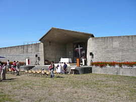 Open-air chapel | |
 Coat of arms | |
show Location of Port-des-Barques | |
 Port-des-Barques | |
| Coordinates: 45°57′00″N 1°04′59″W / 45.95°N 1.083°WCoordinates: 45°57′00″N 1°04′59″W / 45.95°N 1.083°W | |
| Country | France |
| Region | Nouvelle-Aquitaine |
| Department | Charente-Maritime |
| Arrondissement | Rochefort |
| Canton | Tonnay-Charente |
| Government | |
| • Mayor (2020–2026) | Lydie Demené |
| Area 1 | 5.66 km2 (2.19 sq mi) |
| Population (Jan. 2018)[1] | 1,773 |
| • Density | 310/km2 (810/sq mi) |
| Time zone | UTC+01:00 (CET) |
| • Summer (DST) | UTC+02:00 (CEST) |
| INSEE/Postal code | 17484 /17730 |
| Elevation | 0–10 m (0–33 ft) |
| 1 French Land Register data, which excludes lakes, ponds, glaciers > 1 km2 (0.386 sq mi or 247 acres) and river estuaries. | |


Port-des-Barques (French pronunciation: [pɔʁ de baʁk]) is a commune in the Charente-Maritime department, New Aquitaine, southwestern France.
Population[]
| Year | Pop. | ±% |
|---|---|---|
| 1968 | 1,181 | — |
| 1975 | 1,234 | +4.5% |
| 1982 | 1,330 | +7.8% |
| 1990 | 1,455 | +9.4% |
| 1999 | 1,534 | +5.4% |
| 2008 | 1,851 | +20.7% |
See also[]
References[]
- ^ "Populations légales 2018". INSEE. 28 December 2020.
| Wikimedia Commons has media related to Port-des-Barques. |
This Charente-Maritime geographical article is a stub. You can help Wikipedia by . |
Categories:
- Communes of Charente-Maritime
- Charente-Maritime geography stubs