Thénac, Charente-Maritime
Thénac | |
|---|---|
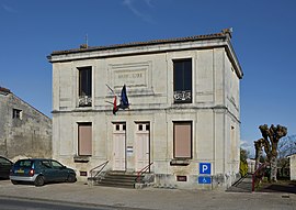 The town hall in Thénac | |
 Coat of arms | |
show Location of Thénac | |
 Thénac | |
| Coordinates: 45°40′07″N 0°39′10″W / 45.6686°N 0.6528°WCoordinates: 45°40′07″N 0°39′10″W / 45.6686°N 0.6528°W | |
| Country | France |
| Region | Nouvelle-Aquitaine |
| Department | Charente-Maritime |
| Arrondissement | Saintes |
| Canton | Thénac |
| Government | |
| • Mayor (2014–2020) | Jean Brethomé |
| Area 1 | 19.17 km2 (7.40 sq mi) |
| Population (Jan. 2018)[1] | 1,676 |
| • Density | 87/km2 (230/sq mi) |
| Time zone | UTC+01:00 (CET) |
| • Summer (DST) | UTC+02:00 (CEST) |
| INSEE/Postal code | 17444 /17460 |
| Elevation | 7–67 m (23–220 ft) (avg. 54 m or 177 ft) |
| 1 French Land Register data, which excludes lakes, ponds, glaciers > 1 km2 (0.386 sq mi or 247 acres) and river estuaries. | |


Thénac (French pronunciation: [tenak]) is a commune in the Charente-Maritime department in southwestern France.
Population[]
| Year | Pop. | ±% |
|---|---|---|
| 1962 | 673 | — |
| 1968 | 705 | +4.8% |
| 1975 | 710 | +0.7% |
| 1982 | 807 | +13.7% |
| 1990 | 922 | +14.3% |
| 1999 | 1,082 | +17.4% |
| 2008 | 1,609 | +48.7% |
See also[]
References[]
- ^ "Populations légales 2018". INSEE. 28 December 2020.
| Wikimedia Commons has media related to Thénac (Charente-Maritime). |
This Charente-Maritime geographical article is a stub. You can help Wikipedia by . |
Categories:
- Communes of Charente-Maritime
- Charente-Maritime geography stubs