Saint-Agnant, Charente-Maritime
show This article may be expanded with text translated from the corresponding article in French. (December 2008) Click [show] for important translation instructions. |
Saint-Agnant | |
|---|---|
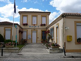 The town hall in Saint-Agnant | |
show Location of Saint-Agnant | |
 Saint-Agnant | |
| Coordinates: 45°52′23″N 0°57′36″W / 45.8731°N 0.96°WCoordinates: 45°52′23″N 0°57′36″W / 45.8731°N 0.96°W | |
| Country | France |
| Region | Nouvelle-Aquitaine |
| Department | Charente-Maritime |
| Arrondissement | Rochefort |
| Canton | Marennes |
| Intercommunality | CA Rochefort Océan |
| Government | |
| • Mayor (2008–2014) | Gilles Trocherie |
| Area 1 | 22.49 km2 (8.68 sq mi) |
| Population (Jan. 2018)[1] | 2,691 |
| • Density | 120/km2 (310/sq mi) |
| Time zone | UTC+01:00 (CET) |
| • Summer (DST) | UTC+02:00 (CEST) |
| INSEE/Postal code | 17308 /17620 |
| Elevation | 2–24 m (6.6–78.7 ft) (avg. 11 m or 36 ft) |
| 1 French Land Register data, which excludes lakes, ponds, glaciers > 1 km2 (0.386 sq mi or 247 acres) and river estuaries. | |


Saint-Agnant is a commune in the Charente-Maritime department in southwestern France.
Population[]
| Year | Pop. | ±% |
|---|---|---|
| 1962 | 1,182 | — |
| 1968 | 1,205 | +1.9% |
| 1975 | 1,346 | +11.7% |
| 1982 | 1,594 | +18.4% |
| 1990 | 1,830 | +14.8% |
| 1999 | 2,083 | +13.8% |
| 2008 | 2,373 | +13.9% |
See also[]
References[]
- ^ "Populations légales 2018". INSEE. 28 December 2020.
| Wikimedia Commons has media related to Saint-Agnant (Charente-Maritime). |
This Charente-Maritime geographical article is a stub. You can help Wikipedia by . |
Categories:
- Communes of Charente-Maritime
- Charente-Maritime geography stubs