Rouffiac, Charente-Maritime
show This article may be expanded with text translated from the corresponding article in French. (December 2008) Click [show] for important translation instructions. |
Rouffiac | |
|---|---|
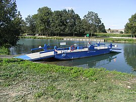 Ferry on the Charente | |
 Coat of arms | |
show Location of Rouffiac | |
 Rouffiac | |
| Coordinates: 45°41′12″N 0°29′21″W / 45.6867°N 0.4892°WCoordinates: 45°41′12″N 0°29′21″W / 45.6867°N 0.4892°W | |
| Country | France |
| Region | Nouvelle-Aquitaine |
| Department | Charente-Maritime |
| Arrondissement | Saintes |
| Canton | Thénac |
| Intercommunality | CA de Saintes |
| Government | |
| • Mayor (2020–2026) | David Musseau |
| Area 1 | 5.85 km2 (2.26 sq mi) |
| Population (Jan. 2018)[1] | 468 |
| • Density | 80/km2 (210/sq mi) |
| Time zone | UTC+01:00 (CET) |
| • Summer (DST) | UTC+02:00 (CEST) |
| INSEE/Postal code | 17304 /17800 |
| Elevation | 2–27 m (6.6–88.6 ft) |
| 1 French Land Register data, which excludes lakes, ponds, glaciers > 1 km2 (0.386 sq mi or 247 acres) and river estuaries. | |


Rouffiac (French pronunciation: [ʁufjak]) is a commune in the Charente-Maritime department in southwestern France.
Population[]
| Year | Pop. | ±% |
|---|---|---|
| 1806 | 398 | — |
| 1820 | 571 | +43.5% |
| 1876 | 526 | −7.9% |
| 1901 | 507 | −3.6% |
| 1911 | 410 | −19.1% |
| 1921 | 361 | −12.0% |
| 1936 | 333 | −7.8% |
| 1946 | 354 | +6.3% |
| 1954 | 344 | −2.8% |
| 1962 | 324 | −5.8% |
| 1968 | 364 | +12.3% |
| 1975 | 396 | +8.8% |
| 1982 | 359 | −9.3% |
| 1990 | 352 | −1.9% |
| 1999 | 327 | −7.1% |
| 2008 | 442 | +35.2% |
See also[]
References[]
- ^ "Populations légales 2018". INSEE. 28 December 2020.
| Wikimedia Commons has media related to Rouffiac (Charente-Maritime). |
This Charente-Maritime geographical article is a stub. You can help Wikipedia by . |
Categories:
- Communes of Charente-Maritime
- Charente-Maritime geography stubs