Rétaud
Rétaud | |
|---|---|
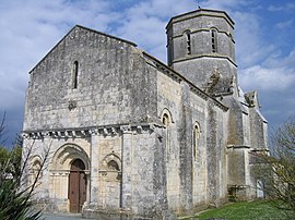 Romanesque church | |
show Location of Rétaud | |
 Rétaud | |
| Coordinates: 45°40′41″N 0°43′38″W / 45.6781°N 0.7272°WCoordinates: 45°40′41″N 0°43′38″W / 45.6781°N 0.7272°W | |
| Country | France |
| Region | Nouvelle-Aquitaine |
| Department | Charente-Maritime |
| Arrondissement | Saintes |
| Canton | Thénac |
| Intercommunality | Gémozac et Saintonge Viticole |
| Government | |
| • Mayor (2020–2026) | Michel Pelletier[1] |
| Area 1 | 19.92 km2 (7.69 sq mi) |
| Population (Jan. 2018)[2] | 1,066 |
| • Density | 54/km2 (140/sq mi) |
| Time zone | UTC+01:00 (CET) |
| • Summer (DST) | UTC+02:00 (CEST) |
| INSEE/Postal code | 17296 /17460 |
| Elevation | 26–49 m (85–161 ft) |
| 1 French Land Register data, which excludes lakes, ponds, glaciers > 1 km2 (0.386 sq mi or 247 acres) and river estuaries. | |


Rétaud (French pronunciation: [ʁeto]) is a commune in the Charente-Maritime department in southwestern France.
Population[]
| Year | Pop. | ±% |
|---|---|---|
| 1962 | 745 | — |
| 1968 | 739 | −0.8% |
| 1975 | 650 | −12.0% |
| 1982 | 740 | +13.8% |
| 1990 | 805 | +8.8% |
| 1999 | 869 | +8.0% |
| 2009 | 957 | +10.1% |
See also[]
References[]
- ^ "Répertoire national des élus: les maires". data.gouv.fr, Plateforme ouverte des données publiques françaises (in French). 2 December 2020.
- ^ "Populations légales 2018". INSEE. 28 December 2020.
| Wikimedia Commons has media related to Rétaud. |
This Charente-Maritime geographical article is a stub. You can help Wikipedia by . |
Categories:
- Communes of Charente-Maritime
- Charente-Maritime geography stubs