Migron, Charente-Maritime
Migron | |
|---|---|
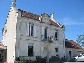 Town hall | |
show Location of Migron | |
 Migron | |
| Coordinates: 45°48′13″N 0°23′46″W / 45.8036°N 0.3961°WCoordinates: 45°48′13″N 0°23′46″W / 45.8036°N 0.3961°W | |
| Country | France |
| Region | Nouvelle-Aquitaine |
| Department | Charente-Maritime |
| Arrondissement | Saintes |
| Canton | Chaniers |
| Government | |
| • Mayor (2020–2026) | Agnès Pottier[1] |
| Area 1 | 15.06 km2 (5.81 sq mi) |
| Population (Jan. 2018)[2] | 723 |
| • Density | 48/km2 (120/sq mi) |
| Time zone | UTC+01:00 (CET) |
| • Summer (DST) | UTC+02:00 (CEST) |
| INSEE/Postal code | 17235 /17770 |
| Elevation | 11–31 m (36–102 ft) |
| 1 French Land Register data, which excludes lakes, ponds, glaciers > 1 km2 (0.386 sq mi or 247 acres) and river estuaries. | |


Migron (French pronunciation: [miɡʁɔ̃]) is a commune in the Charente-Maritime department in southwestern France.
Population[]
| Year | Pop. | ±% |
|---|---|---|
| 1962 | 636 | — |
| 1968 | 667 | +4.9% |
| 1975 | 750 | +12.4% |
| 1982 | 762 | +1.6% |
| 1990 | 740 | −2.9% |
| 1999 | 637 | −13.9% |
| 2008 | 625 | −1.9% |
See also[]
References[]
- ^ "Répertoire national des élus: les maires". data.gouv.fr, Plateforme ouverte des données publiques françaises (in French). 2 December 2020.
- ^ "Populations légales 2018". INSEE. 28 December 2020.
| Wikimedia Commons has media related to Migron (Charente-Maritime). |
This Charente-Maritime geographical article is a stub. You can help Wikipedia by . |
Categories:
- Communes of Charente-Maritime
- Charente-Maritime geography stubs