Pommiers-Moulons
Pommiers-Moulons | |
|---|---|
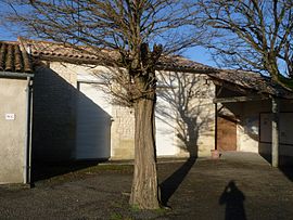 The town hall in Pommiers-Moulons | |
show Location of Pommiers-Moulons | |
 Pommiers-Moulons | |
| Coordinates: 45°19′30″N 0°21′06″W / 45.325°N 0.3517°WCoordinates: 45°19′30″N 0°21′06″W / 45.325°N 0.3517°W | |
| Country | France |
| Region | Nouvelle-Aquitaine |
| Department | Charente-Maritime |
| Arrondissement | Jonzac |
| Canton | Les Trois Monts |
| Intercommunality | Haute-Saintonge |
| Government | |
| • Mayor (2008–2014) | Claude Simon |
| Area 1 | 9.6 km2 (3.7 sq mi) |
| Population (Jan. 2018)[1] | 213 |
| • Density | 22/km2 (57/sq mi) |
| Time zone | UTC+01:00 (CET) |
| • Summer (DST) | UTC+02:00 (CEST) |
| INSEE/Postal code | 17282 /17130 |
| Elevation | 49–114 m (161–374 ft) (avg. 90 m or 300 ft) |
| 1 French Land Register data, which excludes lakes, ponds, glaciers > 1 km2 (0.386 sq mi or 247 acres) and river estuaries. | |


Pommiers-Moulons is a commune in the Charente-Maritime department in southwestern France.
Geography[]
The Seugne forms most of the commune's northeastern border.
Population[]
| Year | Pop. | ±% |
|---|---|---|
| 1962 | 262 | — |
| 1968 | 244 | −6.9% |
| 1975 | 226 | −7.4% |
| 1982 | 203 | −10.2% |
| 1990 | 182 | −10.3% |
| 1999 | 174 | −4.4% |
| 2008 | 190 | +9.2% |
See also[]
References[]
- ^ "Populations légales 2018". INSEE. 28 December 2020.
| Wikimedia Commons has media related to Pommiers-Moulons. |
This Charente-Maritime geographical article is a stub. You can help Wikipedia by . |
Categories:
- Communes of Charente-Maritime
- Charente-Maritime geography stubs