Crouy-sur-Ourcq
Crouy-sur-Ourcq | |
|---|---|
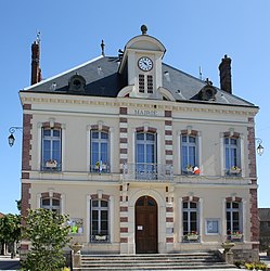 The town hall in Crouy-sur-Ourcq | |
 Coat of arms | |
show Location of Crouy-sur-Ourcq | |
 Crouy-sur-Ourcq | |
| Coordinates: 49°05′23″N 3°04′30″E / 49.0897°N 3.075°ECoordinates: 49°05′23″N 3°04′30″E / 49.0897°N 3.075°E | |
| Country | France |
| Region | Île-de-France |
| Department | Seine-et-Marne |
| Arrondissement | Meaux |
| Canton | La Ferté-sous-Jouarre |
| Intercommunality | Pays de l'Ourcq |
| Government | |
| • Mayor (2020–2026) | Victor Étienne |
| Area 1 | 19.42 km2 (7.50 sq mi) |
| Population (Jan. 2018)[1] | 1,869 |
| • Density | 96/km2 (250/sq mi) |
| Time zone | UTC+01:00 (CET) |
| • Summer (DST) | UTC+02:00 (CEST) |
| INSEE/Postal code | 77148 /77840 |
| Elevation | 52–165 m (171–541 ft) |
| 1 French Land Register data, which excludes lakes, ponds, glaciers > 1 km2 (0.386 sq mi or 247 acres) and river estuaries. | |


Crouy-sur-Ourcq (French pronunciation: [kʁui syʁ uʁk] (![]() listen), literally Crouy on Ourcq) is a commune in the Seine-et-Marne department in the Île-de-France region in north-central France.
listen), literally Crouy on Ourcq) is a commune in the Seine-et-Marne department in the Île-de-France region in north-central France.
Demographics[]
Inhabitants of Crouy-sur-Ourcq are called Crouyciens.
Schools[]
The town has one preschool (école maternelle), one elementary school (école élémentaire), and the junior high school Collège le Champivert.[2]
See also[]
- Château du Houssoy
- Communes of the Seine-et-Marne department
References[]
- ^ "Populations légales 2018". INSEE. 28 December 2020.
- ^ "Ecoles et Périscolaire Archived 2016-04-15 at the Wayback Machine." Crouy-sur-Ourcq. Retrieved on September 3, 2016.
External links[]
| Wikimedia Commons has media related to Crouy-sur-Ourcq. |
- Home page (in French)
- 1999 Land Use, from IAURIF (Institute for Urban Planning and Development of the Paris-Île-de-France région) (in English)
- Base Mérimée: Search for heritage in the commune, Ministère français de la Culture. (in French)
| show Communes of the Seine-et-Marne department |
|---|
| show Authority control |
|---|
This article related to a Seine-et-Marne location is a stub. You can help Wikipedia by . |
Categories:
- Communes of Seine-et-Marne
- Seine-et-Marne geography stubs