Danzhou
Danzhou
儋州市 | |
|---|---|
 Baimajing in Danzhou | |
 Map showing entire Danzhou area within Hainan province | |
| Coordinates (Danzhou municipal government): 19°31′15″N 109°34′51″E / 19.5209°N 109.5808°ECoordinates: 19°31′15″N 109°34′51″E / 19.5209°N 109.5808°E | |
| Country | People's Republic of China |
| Province | Hainan |
| Seat | Nada |
| Area | |
| • Total | 3,394 km2 (1,310 sq mi) |
| Population (2010) | |
| • Total | 932,362 |
| • Density | 270/km2 (710/sq mi) |
| Time zone | UTC+8 (China Standard Time) |
| Postal code | 571700[1] |
| ISO 3166 code | CN-HI-04 |
| Website | www |

Danzhou (Chinese: 儋州; pinyin: Dānzhōu) is a prefecture-level city in the northwest of the Chinese island province of Hainan. Although called a "city", Danzhou administers a large area which was called Dan County or Danxian (儋县) until 1993. The administrative seat and urban center of Danzhou is Nada Town, which is often colloquially referred to as Danzhou city. Danzhou was upgraded from a county-level city into a prefecture-level city in February 2015.
History[]
What is now Danzhou was firstly named Danzhou (儋州) during the Song Dynasty in the 12th century and only renamed to Danxian in 1912 after hundreds of years, but later re-obtained its name Danzhou after the Communist takeover in the 1950s.
During World War 2, Danzhou was among the top most devastated counties in Hainan as the Japanese had massacred more than 30,000 people in Danzhou, destroying over than 10,000 houses and 300 Danzhou villages.[2]
Subdivisions[]
Danzhou is a prefecture-level city of the Hainan province. An uncommon administrative feature is that it has no county-level division. The city government directly administers over 17 towns (镇; zhèn), one state-run institute, and four state-run farms plus an economic development zone:
| Map | ||||||||
|---|---|---|---|---|---|---|---|---|
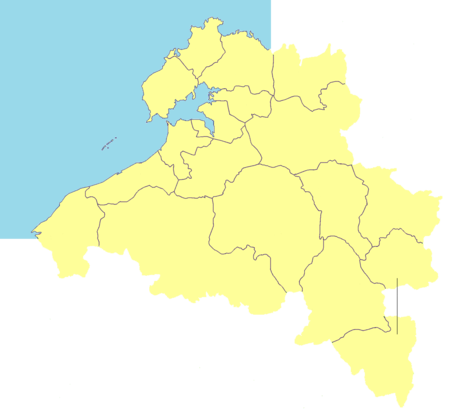
Nada
Heqing
Baimajing
Zhonghe
| ||||||||
| Name | Simplified Chinese | Hanyu Pinyin | Population (2010 census) |
Area (km2) |
Density (/km2) |
Division code[3] | Residential communities | Administrative villages |
| Chengqu District | 城区片区 | Chéngqū Piànqū | 562,863 | 1,468.7 | 383.24 | — | 8 towns | |
| Nada [n 1] | 那大镇 | Nàdà Zhèn | 256,652 | 179.2 | 1432.20 | 460400100 | 10 | 20 |
| Heqing | 和庆镇 | Héqìng Zhèn | 20,729 | 188.4 | 110.03 | 460400101 | 1 | 11 |
| 南丰镇 | Nánfēng Zhèn | 23,669 | 260.3 | 90.93 | 460400102 | 1 | 10 | |
| [n 2] | 大成镇 | Dàchéng Zhèn | 84,620 | 295.4 | 286.46 | 460400103 | 1 | 5 |
| [n 3] | 雅星镇 | Yǎxīng Zhèn | 76,427 | 170 | 449.57 | 460400104 | 2 | 12 |
| [n 4] | 兰洋镇 | Lányáng Zhèn | 23,711 | 186.9 | 126.86 | 460400105 | 1 | 14 |
| 光村镇 | Guāngcūn Zhèn | 27,803 | 72 | 386.15 | 460400106 | 1 | 10 | |
| 东成镇 | Dōngchéng Zhèn | 49,252 | 116.5 | 422.76 | 460400115 | 1 | 21 | |
| Binhai District | 滨海片区 | Bīnhǎi Piànqū | 369,493 | 811.6 | 455.26 | — | 1 subdistrict, 8 towns | |
| [n 5] | 三都街道 | Sāndōu Jiēdào | 76,757 | 88 | 872.23 | 460401001 | 9 | |
| 木棠镇 | Mùtáng Zhèn | 40,373 | 84 | 480.63 | 460400107 | 25 | ||
| 海头镇 | Hǎitóu Zhèn | 34,648 | 195.8 | 176.96 | 460400108 | 4 | 10 | |
| 峨蔓镇 | Émàn Zhèn | 17,317 | 70.5 | 245.63 | 460400109 | 13 | ||
| 王五镇 | Wángwǔ Zhèn | 24,274 | 126.3 | 192.19 | 460400111 | 1 | 8 | |
| Baimajing | 白马井镇 | Báimǎjǐng Zhèn | 59,585 | 54.7 | 1089.30 | 460400112 | 6 | 15 |
| Zhonghe | 中和镇 | Zhōnghé Zhèn | 31,646 | 51.5 | 614.48 | 460400113 | 1 | 11 |
| 排浦镇 | Páipǔ Zhèn | 17,577 | 95.8 | 183.47 | 460400114 | 1 | 7 | |
| 新州镇 | Xīnzhōu Zhèn | 67,316 | 45 | 1495.91 | 460400116 | 12 | 19 | |
Demographics[]
The city's population was 932,362 in 2010. The Han population is 857,342 and the minority population is 75,020.[4]
Language[]
The Danzhou natives speak the Yue Danzhou dialect, unlike the Min Hainanese language that is spoken throughout most of eastern Hainan.
Transportation[]
The area will be served by Danzhou Airport, an under-construction airport approximately 25 km (16 mi) northeast of Nada.[5] It will be international-class, built to handle the increasing number of tourists visiting the area. The airport is scheduled for completion in 2022.[6][7][8]
The Hainan Western Ring High-Speed Railway also provides access.
Climate[]
| Climate data for Danzhou (1981−2010) | |||||||||||||
|---|---|---|---|---|---|---|---|---|---|---|---|---|---|
| Month | Jan | Feb | Mar | Apr | May | Jun | Jul | Aug | Sep | Oct | Nov | Dec | Year |
| Record high °C (°F) | 34.2 (93.6) |
36.2 (97.2) |
38.7 (101.7) |
40.2 (104.4) |
39.2 (102.6) |
37.8 (100.0) |
39.1 (102.4) |
36.6 (97.9) |
35.9 (96.6) |
33.9 (93.0) |
34.0 (93.2) |
31.6 (88.9) |
40.2 (104.4) |
| Average high °C (°F) | 22.9 (73.2) |
24.3 (75.7) |
28.0 (82.4) |
31.5 (88.7) |
32.5 (90.5) |
33.1 (91.6) |
33.2 (91.8) |
32.4 (90.3) |
30.7 (87.3) |
28.7 (83.7) |
25.7 (78.3) |
22.6 (72.7) |
28.8 (83.9) |
| Daily mean °C (°F) | 17.9 (64.2) |
19.2 (66.6) |
22.2 (72.0) |
25.5 (77.9) |
27.0 (80.6) |
28.0 (82.4) |
27.9 (82.2) |
27.3 (81.1) |
26.0 (78.8) |
24.4 (75.9) |
21.4 (70.5) |
18.2 (64.8) |
23.8 (74.8) |
| Average low °C (°F) | 14.6 (58.3) |
15.9 (60.6) |
18.5 (65.3) |
21.8 (71.2) |
23.5 (74.3) |
24.7 (76.5) |
24.5 (76.1) |
24.1 (75.4) |
23.1 (73.6) |
21.6 (70.9) |
18.5 (65.3) |
15.3 (59.5) |
20.5 (68.9) |
| Record low °C (°F) | 5.2 (41.4) |
6.7 (44.1) |
5.3 (41.5) |
13.0 (55.4) |
16.1 (61.0) |
19.4 (66.9) |
20.6 (69.1) |
21.2 (70.2) |
18.0 (64.4) |
12.2 (54.0) |
8.6 (47.5) |
3.7 (38.7) |
3.7 (38.7) |
| Average precipitation mm (inches) | 15.9 (0.63) |
22.5 (0.89) |
39.7 (1.56) |
77.2 (3.04) |
224.6 (8.84) |
199.4 (7.85) |
242.6 (9.55) |
321.6 (12.66) |
307.9 (12.12) |
256.7 (10.11) |
84.1 (3.31) |
36.5 (1.44) |
1,828.7 (72) |
| Average relative humidity (%) | 84 | 84 | 80 | 78 | 80 | 79 | 79 | 83 | 86 | 85 | 83 | 83 | 82 |
| Source: China Meteorological Data Service Center | |||||||||||||
See also[]
| Wikimedia Commons has media related to Danzhou. |
- List of administrative divisions of Hainan
- Danzhou dialect
References[]
- ^ China Postal Codes - Hainan
- ^ [1]
- ^ 中华人民共和国县以上行政区划代码 (in Simplified Chinese). Ministry of Civil Affairs.
- ^ 儋州市第六次人口普查主要数据公报 [Danzhou Sixth Population Census Data Bulletin] (in Simplified Chinese). Archived from the original on 22 May 2013. Retrieved 15 April 2014.
- ^ "Coordinate Distance Calculator".
- ^ "Danzhou Airport New Airport Profile | CAPA".
- ^ "Archived copy". Archived from the original on 15 February 2016. Retrieved 29 December 2015.
{{cite web}}: CS1 maint: archived copy as title (link) - ^ 儋州机场选址初定梅花岭 张琦严朝君出席会议并讲话. Danzhou Municipal People's Government. 19 December 2012. Retrieved 21 July 2018.
Hainan topics | |
|---|---|
Haikou (capital) | |
| General |
|
| Geography |
|
| Flora and fauna |
|
| Media |
|
| Transportation |
|
| Education |
|
| Demographics |
|
| Buildings and structures |
|
| Cuisine |
|
| Visitor attractions |
|
| |
County-level divisions of Hainan Province | ||||||||||||||||||
|---|---|---|---|---|---|---|---|---|---|---|---|---|---|---|---|---|---|---|
Haikou (capital) | ||||||||||||||||||
| Prefecture-level cities |
|  | ||||||||||||||||
| Provincial administered |
| |||||||||||||||||
| ||||||||||||||||||
Notes: *Provincial capitals, ★Sub-provincial cities, ☆Sub-provincial autonomous prefecture *Sub prefectural-level divisions, ✧Largest cities that will approved by the State Council | ||||||||||||||||||||||||||||||||||||||||||||||||||||||||||||||||
|  | |||||||||||||||||||||||||||||||||||||||||||||||||||||||||||||||
|
- Cities in Hainan
- Prefecture-level divisions of Hainan