Franchevelle
Franchevelle | |
|---|---|
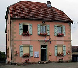 The town hall in Franchevelle | |
 Coat of arms | |
show Location of Franchevelle | |
 Franchevelle | |
| Coordinates: 47°44′28″N 6°27′42″E / 47.7411°N 6.4617°ECoordinates: 47°44′28″N 6°27′42″E / 47.7411°N 6.4617°E | |
| Country | France |
| Region | Bourgogne-Franche-Comté |
| Department | Haute-Saône |
| Arrondissement | Lure |
| Canton | Lure-1 |
| Government | |
| • Mayor (2020–2026) | Raymond Bilquez |
| Area 1 | 10.42 km2 (4.02 sq mi) |
| Population (Jan. 2018)[1] | 439 |
| • Density | 42/km2 (110/sq mi) |
| Time zone | UTC+01:00 (CET) |
| • Summer (DST) | UTC+02:00 (CEST) |
| INSEE/Postal code | 70250 /70200 |
| Elevation | 283–350 m (928–1,148 ft) |
| 1 French Land Register data, which excludes lakes, ponds, glaciers > 1 km2 (0.386 sq mi or 247 acres) and river estuaries. | |


Franchevelle (French pronunciation: [fʁɑ̃ʃvɛl]) is a commune in the Haute-Saône department in the region of Bourgogne-Franche-Comté in eastern France.
See also[]
References[]
- ^ "Populations légales 2018". INSEE. 28 December 2020.
| Wikimedia Commons has media related to Franchevelle. |
This Haute-Saône geographical article is a stub. You can help Wikipedia by . |
Categories:
- Communes of Haute-Saône
- Haute-Saône geography stubs