Frosta
Frosta kommune | |
|---|---|
 Frosta seen from Hellan looking towards Trondheim | |
 Coat of arms 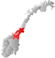 Trøndelag within Norway | |
 Frosta within Trøndelag | |
| Coordinates: 63°36′14″N 10°46′28″E / 63.60389°N 10.77444°ECoordinates: 63°36′14″N 10°46′28″E / 63.60389°N 10.77444°E | |
| Country | Norway |
| County | Trøndelag |
| Established | 1 Jan 1838 |
| Administrative centre | Frosta |
| Government | |
| • Mayor (2019) | Frode Revhaug (H) |
| Area | |
| • Total | 76.32 km2 (29.47 sq mi) |
| • Land | 74.28 km2 (28.68 sq mi) |
| • Water | 2.04 km2 (0.79 sq mi) 2.7% |
| Area rank | 337 in Norway |
| Population (2020) | |
| • Total | 2,627 |
| • Rank | 246 in Norway |
| • Density | 35.4/km2 (92/sq mi) |
| • Change (10 years) | 5.3% |
| Demonym(s) | Frosting[1] |
| Time zone | UTC+01:00 (CET) |
| • Summer (DST) | UTC+02:00 (CEST) |
| ISO 3166 code | NO-5036 |
| Official language form | Neutral[2] |
| Website | frosta |

Frosta is the smallest municipality in Trøndelag county, Norway. The administrative centre is the village of Frosta. The municipality is located along the Trondheimsfjord, on the Frosta peninsula, just north of the city of Trondheim. It also includes the island of Tautra which is connected to the mainland by a causeway bridge.
The 76-square-kilometre (29 sq mi) municipality is the 337th largest by area out of the 356 municipalities in Norway. Frosta is the 246th most populous municipality in Norway with a population of 2,627. The municipality's population density is 35.4 inhabitants per square kilometre (92/sq mi) and its population has increased by 5.3% over the previous 10-year period.[3][4]
General information[]
Frosta was established as a municipality on 1 January 1838 (see formannskapsdistrikt). It is one of very few municipalities in Norway with unchanged borders since that date.[5] In 2018, the municipality, which was part of the old Nord-Trøndelag county became part of the new Trøndelag county.
Name[]
The Old Norse form of the name was (also) Frosta. The meaning of the name is unknown. Historically, the name was also spelled Frosten.[6]
Coat of arms[]
The coat of arms was granted on 26 June 1987. The arms show a gold sceptre or mace on a green background. The coat of arms was inspired by the old seal of the medieval Frostating assembly, where King Magnus VI the law-mender is sitting with a lily sceptre in his hand. Frosta was one of the historic places of justice, so this was chosen to commemorate that fact.[7][8]
Geography[]
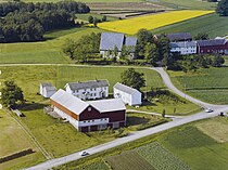
Frosta is on a peninsula in the Trondheimsfjord, about 20 km (12 mi) northeast of Trondheim. By road the distance is about 75 km (47 mi) Frosta is sometimes nicknamed "Trondheim's kitchen garden" due to many farms with production of vegetables, as well as a good microclimate.
Climate[]
Frosta has a predominantly temperate oceanic climate/marine west coast climate (barely humid continental if 0 °C is used as winter threshold). The driest month is May and the wettest is December. The all-time high temperature is 34.1 °C (93.4 °F) recorded July 2019; the all-time low is −20.7 °C (−5.3 °F) recorded in February 2010. The warmest month on record was July 2014 with average high 25.9 °C (78.6 °F), average low 14.9 °C (58.8 °F) and mean 19.7 °C (67.5 °F). The coldest month on record was December 2010 with average high −3.6 °C (25.5 °F), average low −8.9 °C (16.0 °F) and mean −6 °C (21 °F). The weather station was established in December 1989.
| hideClimate data for Frosta 1991-2020 (32 m, extremes 2010-2020) | |||||||||||||
|---|---|---|---|---|---|---|---|---|---|---|---|---|---|
| Month | Jan | Feb | Mar | Apr | May | Jun | Jul | Aug | Sep | Oct | Nov | Dec | Year |
| Record high °C (°F) | 11.3 (52.3) |
10.8 (51.4) |
13.4 (56.1) |
23.4 (74.1) |
27.7 (81.9) |
33 (91) |
34.1 (93.4) |
29.7 (85.5) |
25.4 (77.7) |
20 (68) |
13.7 (56.7) |
9.9 (49.8) |
34.1 (93.4) |
| Daily mean °C (°F) | −0.3 (31.5) |
−0.7 (30.7) |
1.3 (34.3) |
5.2 (41.4) |
9.2 (48.6) |
12.6 (54.7) |
15.2 (59.4) |
14.8 (58.6) |
11.1 (52.0) |
6.2 (43.2) |
2.8 (37.0) |
0.1 (32.2) |
6.5 (43.6) |
| Record low °C (°F) | −18.7 (−1.7) |
−20.7 (−5.3) |
−16 (3) |
−4.7 (23.5) |
−1.3 (29.7) |
2.1 (35.8) |
5.2 (41.4) |
4.7 (40.5) |
0.6 (33.1) |
−5.9 (21.4) |
−13.5 (7.7) |
−17.1 (1.2) |
−20.7 (−5.3) |
| Average precipitation mm (inches) | 74.4 (2.93) |
75.3 (2.96) |
72.6 (2.86) |
54.2 (2.13) |
51.9 (2.04) |
73.6 (2.90) |
72.3 (2.85) |
90.6 (3.57) |
87.6 (3.45) |
84.9 (3.34) |
80.2 (3.16) |
97.6 (3.84) |
915.2 (36.03) |
| Source: Norwegian Meteorological Institute[9] | |||||||||||||
Churches[]
The Church of Norway has one parish (sokn) within the municipality of Frosta. It is part of the Sør-Innherad prosti (deanery) in the Diocese of Nidaros.
| Parish (sokn) | Church Name | Location of the Church | Year Built |
|---|---|---|---|
| Frosta | Frosta Church | Frosta | 1866 |
| Logtun Church | Logtun | 16th century |
History[]

Several rock engraving sites can be found in the parish, together with burial mounds from Viking times. Archaeologists have for the first time found the remnants of a Viking harbour (Vikinghavna på Fånestangen) in Norway at Frosta. A number of logs sticking up along the shoreline at Frosta have been dated back to around year 1000.
Norway's oldest court, Frostating, had its seat here at Tinghaugen, close to the medieval church at Logtun. On the island of Tautra can be found the remains of Tautra Abbey, a Trappist (Reformed Cistercian) convent, established in 1207.
Government[]
All municipalities in Norway, including Frosta, are responsible for primary education (through 10th grade), outpatient health services, senior citizen services, unemployment and other social services, zoning, economic development, and municipal roads. The municipality is governed by a municipal council of elected representatives, which in turn elect a mayor.[10] The municipality falls under the Inntrøndelag District Court and the Frostating Court of Appeal.
Municipal council[]
The municipal council (Kommunestyre) of Frosta is made up of 17 representatives that are elected to four year terms. The party breakdown of the council is as follows:
| Party Name (in Norwegian) | Number of representatives | |
|---|---|---|
| Labour Party (Arbeiderpartiet) | 5 | |
| Conservative Party (Høyre) | 6 | |
| Centre Party (Senterpartiet) | 5 | |
| Liberal Party (Venstre) | 1 | |
| Total number of members: | 17 | |
Mayor[]
The mayors of Frosta (incomplete list):
- 2019–present: Frode Revhaug (H)
- 2015-2019: Trine Haug (Sp)
- 2011-2015: Johan Petter Skogseth (Sp)
- 2009-2011: Frode Revhaug (H)
- 2003-2009: Lars Myraune (H)
- 1999-2003: Boje Reitan (SV)
Economy[]
Agriculture makes up the largest business in Frosta, which is sometimes called "Trondheim's kitchen garden" due to the substantial production of vegetables, strawberries, and flowers.
Notable residents[]

- Lars Myraune (born 1944 in Frosta) a military leader, politician and Mayor of Frosta 2003–2009
- Karin Pettersen (born 1964 in Frosta) is team handball player and team silver medallist at the 1988 & 1992 Summer Olympics
- Vidar Riseth (born 1972 in Frosta) former football player with over 400 club caps and 52 for Norway
- Anna Ceselie Brustad Moe (born 1975) politician for the Centre Party
References[]
- ^ "Navn på steder og personer: Innbyggjarnamn" (in Norwegian). Språkrådet.
- ^ "Forskrift om målvedtak i kommunar og fylkeskommunar" (in Norwegian). Lovdata.no.
- ^ Statistisk sentralbyrå (2020). "Table: 06913: Population 1 January and population changes during the calendar year (M)" (in Norwegian).
- ^ Statistisk sentralbyrå (2020). "09280: Area of land and fresh water (km²) (M)" (in Norwegian).
- ^ Jukvam, Dag (1999). "Historisk oversikt over endringer i kommune- og fylkesinndelingen" (PDF) (in Norwegian). Statistisk sentralbyrå.
- ^ Rygh, Oluf (1903). Norske gaardnavne: Nordre Trondhjems amt (dokpro.uio.no) (in Norwegian) (15 ed.). Kristiania, Norge: W. C. Fabritius & sønners bogtrikkeri. p. 62.
- ^ "Nord-Trøndelag fylke" (in Norwegian). Retrieved 2008-10-29.
- ^ "Civic heraldry of Norway - Norske Kommunevåpen". Heraldry of the World. Retrieved 2018-03-29.
- ^ http://sharki.oslo.dnmi.no/portal/page?_pageid=73,39035,73_39080&_dad=portal&_schema=PORTAL. Missing or empty
|title=(help) - ^ Hansen, Tore, ed. (2016-05-12). "kommunestyre". Store norske leksikon (in Norwegian). Kunnskapsforlaget. Retrieved 2019-01-01.
- ^ "Tall for Norge: Kommunestyrevalg 2019 - Trøndelag". Valg Direktoratet. Retrieved 2019-10-19.
- ^ Jump up to: a b c d "Table: 04813: Members of the local councils, by party/electoral list at the Municipal Council election (M)" (in Norwegian). Statistics Norway.
- ^ "Tall for Norge: Kommunestyrevalg 2011 - Nord-Trøndelag". Valg Direktoratet. Retrieved 2019-10-19.
- ^ "Kommunestyrevalget 1995" (PDF) (in Norwegian). Oslo-Kongsvinger: Statistisk sentralbyrå. 1996. Retrieved 2020-04-12.
- ^ "Kommunestyrevalget 1991" (PDF) (in Norwegian). Oslo-Kongsvinger: Statistisk sentralbyrå. 1993. Retrieved 2020-04-12.
- ^ "Kommunestyrevalget 1987" (PDF) (in Norwegian). Oslo-Kongsvinger: Statistisk sentralbyrå. 1988. Retrieved 2020-04-12.
- ^ "Kommunestyrevalget 1983" (PDF) (in Norwegian). Oslo-Kongsvinger: Statistisk sentralbyrå. 1984. Retrieved 2020-04-12.
- ^ "Kommunestyrevalget 1979" (PDF) (in Norwegian). Oslo: Statistisk sentralbyrå. 1979. Retrieved 2020-04-12.
- ^ "Kommunevalgene 1975" (PDF) (in Norwegian). Oslo: Statistisk sentralbyrå. 1977. Retrieved 2020-04-12.
- ^ "Kommunevalgene 1972" (PDF) (in Norwegian). Oslo: Statistisk sentralbyrå. 1973. Retrieved 2020-04-12.
- ^ "Kommunevalgene 1967" (PDF) (in Norwegian). Oslo: Statistisk sentralbyrå. 1967. Retrieved 2020-04-12.
- ^ "Kommunevalgene 1963" (PDF) (in Norwegian). Oslo: Statistisk sentralbyrå. 1964. Retrieved 2020-04-12.
- ^ "Kommunevalgene og Ordførervalgene 1959" (PDF) (in Norwegian). Oslo: Statistisk sentralbyrå. 1960. Retrieved 2020-04-12.
- ^ "Kommunevalgene og Ordførervalgene 1955" (PDF) (in Norwegian). Oslo: Statistisk sentralbyrå. 1957. Retrieved 2020-04-12.
- ^ "Kommunevalgene og Ordførervalgene 1951" (PDF) (in Norwegian). Oslo: Statistisk sentralbyrå. 1952. Retrieved 2020-04-12.
- ^ "Kommunevalgene og Ordførervalgene 1947" (PDF) (in Norwegian). Oslo: Statistisk sentralbyrå. 1948. Retrieved 2020-04-12.
- ^ "Kommunevalgene og Ordførervalgene 1945" (PDF) (in Norwegian). Oslo: Statistisk sentralbyrå. 1947. Retrieved 2020-04-12.
- ^ "Kommunevalgene og Ordførervalgene 1937" (PDF) (in Norwegian). Oslo: Statistisk sentralbyrå. 1938. Retrieved 2020-04-12.
External links[]
| Wikimedia Commons has media related to Frosta. |
 Trøndelag travel guide from Wikivoyage
- Municipal fact sheet from Statistics Norway (in Norwegian)
- Turist information (in Norwegian)
- Local newspaper (in Norwegian)
- Tautra Cistercian abbey
- Municipal main page (in Norwegian)
- The international Frosta festival (in Norwegian)
- Hauganfjæra Camping (in Norwegian)
| hide Trøndelag county, Norway | |||
|---|---|---|---|
| |||
 | Towns and cities |  | |
| Municipalities | |||
| show Authority control |
|---|
- Frosta
- Municipalities of Trøndelag
- 1838 establishments in Norway