Vikna
Vikna kommune | |
|---|---|
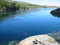
 View of Rørvik | |
 Coat of arms 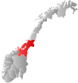 Trøndelag within Norway | |
 Vikna within Trøndelag | |
| Coordinates: 64°54′42″N 11°01′55″E / 64.91167°N 11.03194°ECoordinates: 64°54′42″N 11°01′55″E / 64.91167°N 11.03194°E | |
| Country | Norway |
| County | Trøndelag |
| District | Namdalen |
| Established | 1 July 1869 |
| Disestablished | 1 Jan 2020 |
| Administrative centre | Rørvik |
| Government | |
| • Mayor (2015-2019) | (AP) |
| Area | |
| • Total | 318.69 km2 (123.05 sq mi) |
| • Land | 311.17 km2 (120.14 sq mi) |
| • Water | 7.52 km2 (2.90 sq mi) 2.4% |
| Area rank | 269 in Norway |
| *Area at municipal dissolution. | |
| Population (2018) | |
| • Total | 4,492 |
| • Rank | 221 in Norway |
| • Density | 14.4/km2 (37/sq mi) |
| • Change (10 years) | 11.4% |
| Demonym(s) | Viknværing Viknaværing[1] |
| Time zone | UTC+01:00 (CET) |
| • Summer (DST) | UTC+02:00 (CEST) |
| ISO 3166 code | NO-5050 |
| Official language form | Neutral[2] |
| Preceded by | Nærøy in 1869 |
| Succeeded by | Nærøysund in 2020 |
| Website | vikna |

Vikna is a former municipality in Trøndelag county, Norway. The municipality existed from 1869 until its dissolution in 2020 when it joined Nærøysund Municipality. It was part of the Namdalen region. The administrative centre of the municipality was the village of Rørvik. Other villages in Vikna included Austafjord, Garstad, and Valøya.

At the time of its dissolution in 2020, the 319-square-kilometre (123 sq mi) municipality was the 269th largest by area out of the 422 municipalities in Norway. Vikna was the 221st most populous municipality in Norway with a population of 4,492. The municipality's population density was 14.4 inhabitants per square kilometre (37/sq mi) and its population had increased by 11.4% over the last decade.[3][4]
General information[]
The municipality of Vikten was established on 1 July 1869 when it was separated from the large municipality of Nærøy. Initially, the population of Vikten was 1,749. On 1 January 1881, a small area of Fosnes (population: 61) was transferred to Vikten. The name of the municipality was later changed to Vikna.[5]
On 1 January 2018, the municipality switched from the old Nord-Trøndelag county to the new Trøndelag county.
On 1 January 2020, the municipality of Vikna was merged with most of the neighboring municipality of Nærøy to form the new Nærøysund Municipality.[6] The Lund area in Nærøy was not part of the merger. It became part of the newly enlarged Namsos Municipality on the same date.[7]
Name[]
The municipality was named after the three large islands in the municipality: Inner-Vikna, Mellom-Vikna, and Ytter-Vikna (Old Norse: Víkn). The name is derived from the word vík which means "cove" or "wick". (The islands are scored by numerous coves and inlets.)[8]
Coat of arms[]
The coat of arms was granted on 13 May 1988. The arms show three white salmon on a blue background. This was chosen because salmon fishing and farming was (and still is) an important source of income in the municipality.[9]
Churches[]
The Church of Norway had one parish (sokn) within the municipality of Vikna. It was part of the Namdal prosti (deanery) in the Diocese of Nidaros.
| Parish (sokn) | Church Name | Location of the Church | Year Built |
|---|---|---|---|
| Vikna | Garstad Church | Garstad | 1856 |
| Rørvik Church | Rørvik | 1896 | |
| Valøy Chapel | Valøya | 1972 |
Geography[]

The municipality consisted of a large island archipelago with some 6,000 large and small islands going far into the Norwegian Sea off the northwestern coast of Trøndelag county. Vikna is the largest spawning area for cod south of Lofoten. The three largest islands are: Inner-Vikna, closest to the mainland, Mellom-Vikna, and then Ytter-Vikna as the westernmost island. Other islands include Borgan and Lauvøya.
The main village for the municipality was Rørvik, located on the eastern shore of Inner-Vikna, facing the mainland across the Nærøysundet strait. The many islands in the area means that there are many lighthouses including Gjeslingene Lighthouse, Grinna Lighthouse, Nærøysund Lighthouse, and Nordøyan Lighthouse.
On 21 October 1962, the coastal steamer (Hurtigruten) Sanct Svithun run aground on Nordøyan as a result of navigational error. The ship sunk, and there was a tragic loss of 41 lives. A memorial bauta was raised on Nordøyan in 2002.
Government[]
All municipalities in Norway, including Vikna, are responsible for primary education (through 10th grade), outpatient health services, senior citizen services, unemployment and other social services, zoning, economic development, and municipal roads. The municipality is governed by a municipal council of elected representatives, which in turn elect a mayor.[10] The municipality falls under the Namdal District Court and the Frostating Court of Appeal.
Municipal council[]
The municipal council (Kommunestyre) of Vikna is made up of 23 representatives that are elected to four year terms. The party breakdown of the final municipal council was as follows:
| Party Name (in Norwegian) | Number of representatives | |
|---|---|---|
| Labour Party (Arbeiderpartiet) | 8 | |
| Progress Party (Fremskrittspartiet) | 2 | |
| Conservative Party (Høyre) | 1 | |
| Christian Democratic Party (Kristelig Folkeparti) | 1 | |
| Centre Party (Senterpartiet) | 3 | |
| Socialist Left Party (Sosialistisk Venstreparti) | 1 | |
| Liberal Party (Venstre) | 7 | |
| Total number of members: | 23 | |
| Party Name (in Norwegian) | Number of representatives | |
|---|---|---|
| Labour Party (Arbeiderpartiet) | 6 | |
| Progress Party (Fremskrittspartiet) | 4 | |
| Conservative Party (Høyre) | 4 | |
| Christian Democratic Party (Kristelig Folkeparti) | 2 | |
| Centre Party (Senterpartiet) | 3 | |
| Socialist Left Party (Sosialistisk Venstreparti) | 1 | |
| Liberal Party (Venstre) | 3 | |
| Total number of members: | 23 | |
| Party Name (in Norwegian) | Number of representatives | |
|---|---|---|
| Labour Party (Arbeiderpartiet) | 5 | |
| Progress Party (Fremskrittspartiet) | 5 | |
| Conservative Party (Høyre) | 2 | |
| Christian Democratic Party (Kristelig Folkeparti) | 5 | |
| Centre Party (Senterpartiet) | 2 | |
| Socialist Left Party (Sosialistisk Venstreparti) | 1 | |
| Liberal Party (Venstre) | 3 | |
| Total number of members: | 23 | |
| Party Name (in Norwegian) | Number of representatives | |
|---|---|---|
| Labour Party (Arbeiderpartiet) | 5 | |
| Progress Party (Fremskrittspartiet) | 3 | |
| Conservative Party (Høyre) | 4 | |
| Christian Democratic Party (Kristelig Folkeparti) | 4 | |
| Centre Party (Senterpartiet) | 2 | |
| Socialist Left Party (Sosialistisk Venstreparti) | 2 | |
| Liberal Party (Venstre) | 3 | |
| Total number of members: | 23 | |
| Party Name (in Norwegian) | Number of representatives | |
|---|---|---|
| Labour Party (Arbeiderpartiet) | 6 | |
| Progress Party (Fremskrittspartiet) | 2 | |
| Conservative Party (Høyre) | 6 | |
| Christian Democratic Party (Kristelig Folkeparti) | 2 | |
| Centre Party (Senterpartiet) | 3 | |
| Socialist Left Party (Sosialistisk Venstreparti) | 2 | |
| Liberal Party (Venstre) | 2 | |
| Total number of members: | 23 | |
| Party Name (in Norwegian) | Number of representatives | |
|---|---|---|
| Labour Party (Arbeiderpartiet) | 7 | |
| Progress Party (Fremskrittspartiet) | 2 | |
| Conservative Party (Høyre) | 3 | |
| Centre Party (Senterpartiet) | 8 | |
| Socialist Left Party (Sosialistisk Venstreparti) | 1 | |
| Liberal Party (Venstre) | 2 | |
| Total number of members: | 23 | |
| Party Name (in Norwegian) | Number of representatives | |
|---|---|---|
| Labour Party (Arbeiderpartiet) | 8 | |
| Progress Party (Fremskrittspartiet) | 1 | |
| Conservative Party (Høyre) | 3 | |
| Centre Party (Senterpartiet) | 7 | |
| Socialist Left Party (Sosialistisk Venstreparti) | 2 | |
| Liberal Party (Venstre) | 2 | |
| Total number of members: | 23 | |
| Party Name (in Norwegian) | Number of representatives | |
|---|---|---|
| Labour Party (Arbeiderpartiet) | 10 | |
| Progress Party (Fremskrittspartiet) | 3 | |
| Conservative Party (Høyre) | 3 | |
| Christian Democratic Party (Kristelig Folkeparti) | 1 | |
| Centre Party (Senterpartiet) | 3 | |
| Socialist Left Party (Sosialistisk Venstreparti) | 1 | |
| Liberal Party (Venstre) | 2 | |
| Total number of members: | 23 | |
| Party Name (in Norwegian) | Number of representatives | |
|---|---|---|
| Labour Party (Arbeiderpartiet) | 11 | |
| Conservative Party (Høyre) | 5 | |
| Christian Democratic Party (Kristelig Folkeparti) | 1 | |
| Centre Party (Senterpartiet) | 3 | |
| Socialist Left Party (Sosialistisk Venstreparti) | 1 | |
| Liberal Party (Venstre) | 2 | |
| Total number of members: | 23 | |
| Party Name (in Norwegian) | Number of representatives | |
|---|---|---|
| Labour Party (Arbeiderpartiet) | 9 | |
| Conservative Party (Høyre) | 5 | |
| Christian Democratic Party (Kristelig Folkeparti) | 1 | |
| Centre Party (Senterpartiet) | 4 | |
| Socialist Left Party (Sosialistisk Venstreparti) | 1 | |
| Liberal Party (Venstre) | 3 | |
| Total number of members: | 23 | |
| Party Name (in Norwegian) | Number of representatives | |
|---|---|---|
| Labour Party (Arbeiderpartiet) | 7 | |
| Conservative Party (Høyre) | 3 | |
| Christian Democratic Party (Kristelig Folkeparti) | 2 | |
| Centre Party (Senterpartiet) | 6 | |
| Socialist Left Party (Sosialistisk Venstreparti) | 2 | |
| Liberal Party (Venstre) | 3 | |
| Total number of members: | 23 | |
| Party Name (in Norwegian) | Number of representatives | |
|---|---|---|
| Labour Party (Arbeiderpartiet) | 10 | |
| Conservative Party (Høyre) | 2 | |
| Christian Democratic Party (Kristelig Folkeparti) | 1 | |
| Centre Party (Senterpartiet) | 7 | |
| Liberal Party (Venstre) | 3 | |
| Total number of members: | 23 | |
| Party Name (in Norwegian) | Number of representatives | |
|---|---|---|
| Labour Party (Arbeiderpartiet) | 10 | |
| Conservative Party (Høyre) | 1 | |
| Christian Democratic Party (Kristelig Folkeparti) | 1 | |
| Centre Party (Senterpartiet) | 6 | |
| Liberal Party (Venstre) | 5 | |
| Total number of members: | 23 | |
| Party Name (in Norwegian) | Number of representatives | |
|---|---|---|
| Labour Party (Arbeiderpartiet) | 12 | |
| Conservative Party (Høyre) | 2 | |
| Christian Democratic Party (Kristelig Folkeparti) | 1 | |
| Centre Party (Senterpartiet) | 4 | |
| Liberal Party (Venstre) | 4 | |
| Total number of members: | 23 | |
| Party Name (in Norwegian) | Number of representatives | |
|---|---|---|
| Labour Party (Arbeiderpartiet) | 10 | |
| Conservative Party (Høyre) | 1 | |
| Christian Democratic Party (Kristelig Folkeparti) | 1 | |
| Centre Party (Senterpartiet) | 5 | |
| Liberal Party (Venstre) | 6 | |
| Total number of members: | 23 | |
| Party Name (in Norwegian) | Number of representatives | |
|---|---|---|
| Labour Party (Arbeiderpartiet) | 10 | |
| Conservative Party (Høyre) | 1 | |
| Christian Democratic Party (Kristelig Folkeparti) | 1 | |
| Farmers' Party (Bondepartiet) | 5 | |
| Liberal Party (Venstre) | 4 | |
| Local List(s) (Lokale lister) | 2 | |
| Total number of members: | 23 | |
| Party Name (in Norwegian) | Number of representatives | |
|---|---|---|
| Labour Party (Arbeiderpartiet) | 8 | |
| Conservative Party (Høyre) | 1 | |
| Farmers' Party (Bondepartiet) | 4 | |
| Liberal Party (Venstre) | 7 | |
| Total number of members: | 20 | |
| Party Name (in Norwegian) | Number of representatives | |
|---|---|---|
| Labour Party (Arbeiderpartiet) | 6 | |
| Conservative Party (Høyre) | 1 | |
| Communist Party (Kommunistiske Parti) | 1 | |
| Farmers' Party (Bondepartiet) | 4 | |
| Liberal Party (Venstre) | 8 | |
| Total number of members: | 20 | |
| Party Name (in Norwegian) | Number of representatives | |
|---|---|---|
| Labour Party (Arbeiderpartiet) | 9 | |
| Conservative Party (Høyre) | 1 | |
| Communist Party (Kommunistiske Parti) | 1 | |
| Farmers' Party (Bondepartiet) | 3 | |
| Liberal Party (Venstre) | 6 | |
| Total number of members: | 20 | |
| Party Name (in Norwegian) | Number of representatives | |
|---|---|---|
| Labour Party (Arbeiderpartiet) | 8 | |
| Farmers' Party (Bondepartiet) | 3 | |
| Liberal Party (Venstre) | 7 | |
| Joint List(s) of Non-Socialist Parties (Borgerlige Felleslister) | 2 | |
| Total number of members: | 20 | |
Economy[]
Fishing, fish farming, public services, and agriculture are the main sources of income. The Norveg museum, devoted to the coastal way of life through the centuries, is located in Rørvik. The Vikna Wind Farm is located on Mellom-Vikna, just west of Garstad, and it produces power for much of the municipality.
Transportation[]
Hurtigruten boats stop frequently at Rørvik and via the Nærøysund Bridge connects Vikna to the mainland and European route E6. There is also the small Rørvik Airport, Ryum, just south of Rørvik. Vikna and neighbouring Nærøy form a common work area with nearly 10,000 inhabitants.
Notable people[]
See also[]
References[]
- ^ "Navn på steder og personer: Innbyggjarnamn" (in Norwegian). Språkrådet.
- ^ "Forskrift om målvedtak i kommunar og fylkeskommunar" (in Norwegian). Lovdata.no.
- ^ Statistisk sentralbyrå (2018). "Table: 06913: Population 1 January and population changes during the calendar year (M)" (in Norwegian). Retrieved 2019-03-03.
- ^ Statistisk sentralbyrå. "09280: Area of land and fresh water (km²) (M)" (in Norwegian). Retrieved 2019-03-03.
- ^ Jukvam, Dag (1999). "Historisk oversikt over endringer i kommune- og fylkesinndelingen" (PDF) (in Norwegian). Statistisk sentralbyrå.
- ^ "Om Nærøysund kommune" (in Norwegian). Nærøysund kommune. Retrieved 2019-03-03.
- ^ "Vedtak om grensejustering mellom Nærøy og Fosnes kommuner" (PDF) (in Norwegian). Retrieved 2019-12-30.
- ^ Rygh, Oluf (1903). Norske gaardnavne: Nordre Trondhjems amt (dokpro.uio.no) (in Norwegian) (15 ed.). Kristiania, Norge: W. C. Fabritius & sønners bogtrikkeri. p. 359.
- ^ "Civic heraldry of Norway - Norske Kommunevåpen". Heraldry of the World. Retrieved 2018-05-05.
- ^ Hansen, Tore, ed. (2016-05-12). "kommunestyre". Store norske leksikon (in Norwegian). Kunnskapsforlaget. Retrieved 2019-01-01.
- ^ a b c d "Table: 04813: Members of the local councils, by party/electoral list at the Municipal Council election (M)" (in Norwegian). Statistics Norway.
- ^ "Tall for Norge: Kommunestyrevalg 2011 - Nord-Trøndelag". Valg Direktoratet. Retrieved 2019-10-20.
- ^ "Kommunestyrevalget 1995" (PDF) (in Norwegian). Oslo-Kongsvinger: Statistisk sentralbyrå. 1996. Retrieved 2020-04-14.
- ^ "Kommunestyrevalget 1991" (PDF) (in Norwegian). Oslo-Kongsvinger: Statistisk sentralbyrå. 1993. Retrieved 2020-04-14.
- ^ "Kommunestyrevalget 1987" (PDF) (in Norwegian). Oslo-Kongsvinger: Statistisk sentralbyrå. 1988. Retrieved 2020-04-14.
- ^ "Kommunestyrevalget 1983" (PDF) (in Norwegian). Oslo-Kongsvinger: Statistisk sentralbyrå. 1984. Retrieved 2020-04-14.
- ^ "Kommunestyrevalget 1979" (PDF) (in Norwegian). Oslo: Statistisk sentralbyrå. 1979. Retrieved 2020-04-14.
- ^ "Kommunevalgene 1975" (PDF) (in Norwegian). Oslo: Statistisk sentralbyrå. 1977. Retrieved 2020-04-14.
- ^ "Kommunevalgene 1972" (PDF) (in Norwegian). Oslo: Statistisk sentralbyrå. 1973. Retrieved 2020-04-14.
- ^ "Kommunevalgene 1967" (PDF) (in Norwegian). Oslo: Statistisk sentralbyrå. 1967. Retrieved 2020-04-14.
- ^ "Kommunevalgene 1963" (PDF) (in Norwegian). Oslo: Statistisk sentralbyrå. 1964. Retrieved 2020-04-14.
- ^ "Kommunevalgene og Ordførervalgene 1959" (PDF) (in Norwegian). Oslo: Statistisk sentralbyrå. 1960. Retrieved 2020-04-14.
- ^ "Kommunevalgene og Ordførervalgene 1955" (PDF) (in Norwegian). Oslo: Statistisk sentralbyrå. 1957. Retrieved 2020-04-14.
- ^ "Kommunevalgene og Ordførervalgene 1951" (PDF) (in Norwegian). Oslo: Statistisk sentralbyrå. 1952. Retrieved 2020-04-14.
- ^ "Kommunevalgene og Ordførervalgene 1947" (PDF) (in Norwegian). Oslo: Statistisk sentralbyrå. 1948. Retrieved 2020-04-14.
- ^ "Kommunevalgene og Ordførervalgene 1945" (PDF) (in Norwegian). Oslo: Statistisk sentralbyrå. 1947. Retrieved 2020-04-14.
- ^ "Kommunevalgene og Ordførervalgene 1937" (PDF) (in Norwegian). Oslo: Statistisk sentralbyrå. 1938. Retrieved 2020-04-14.
External links[]
| Wikimedia Commons has media related to Vikna. |
 Trøndelag travel guide from Wikivoyage
- Norveg Museum
- Cultural map of Vikna (in Norwegian)
- The plant cover of Kalvøya island
Trøndelag county, Norway | |||||||||||
|---|---|---|---|---|---|---|---|---|---|---|---|
| |||||||||||
 | Towns and cities |  | |||||||||
| Municipalities |
| ||||||||||
- Vikna
- Nærøysund
- Former municipalities of Norway
- Archipelagoes of the Atlantic Ocean
- Archipelagoes of Norway
- 1869 establishments in Norway
- 2020 disestablishments in Norway
- Populated places disestablished in 2020