Røyrvik
Røyrvik kommune
Raarvihken tjïelte | |
|---|---|
 View of the village of Røyrvik | |
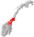 Trøndelag within Norway | |
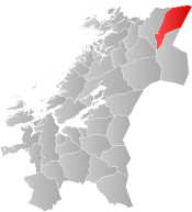 Røyrvik within Trøndelag | |
| Coordinates: 64°55′15″N 13°39′03″E / 64.92083°N 13.65083°ECoordinates: 64°55′15″N 13°39′03″E / 64.92083°N 13.65083°E | |
| Country | Norway |
| County | Trøndelag |
| District | Namdalen |
| Established | 1 July 1923 |
| Administrative centre | Røyrvik |
| Government | |
| • Mayor (2015) | Hans Oskar Devik (Sp) |
| Area | |
| • Total | 1,584.75 km2 (611.88 sq mi) |
| • Land | 1,329.63 km2 (513.37 sq mi) |
| • Water | 255.12 km2 (98.50 sq mi) 16.1% |
| Area rank | 50 in Norway |
| Population (2020) | |
| • Total | 461 |
| • Rank | 353 in Norway |
| • Density | 0.3/km2 (0.8/sq mi) |
| • Change (10 years) | −6.9% |
| Time zone | UTC+01:00 (CET) |
| • Summer (DST) | UTC+02:00 (CEST) |
| ISO 3166 code | NO-5043 |
| Official language form | Neutral[1] |
| Website | royrvik |

Røyrvik (Southern Sami: Raarvihke, Swedish: Röyrvik) is a municipality in Trøndelag county, Norway. It is part of the Namdalen region. The administrative centre of the municipality is the village of Røyrvik. The area has always had a strong Sami influence. The village lays relatively close to the border with Sweden and the municipal boundary eastwards forms part of the international border.
The 1,585-square-kilometre (612 sq mi) municipality is the 50th largest by area out of the 356 municipalities in Norway. Røyrvik is the 353rd most populous municipality in Norway with a population of 461 making it the 4th smallest population in Norway. The municipality's population density is 0.3 inhabitants per square kilometre (0.78/sq mi) and its population has decreased by 6.9% over the previous 10-year period.[2][3]
General information[]
The municipality of Røyrvik was established on 1 July 1923 when it was separated from the municipality of Grong. Initially, the population was 392. The municipal boundaries have not since changed.[4] On 1 January 2018, the municipality switched from the old Nord-Trøndelag county to the new Trøndelag county.
Name[]
The municipality (originally the parish) is named after the old Røyrvik farm (historically: Røirviken), since the first church, Røyrvik Church, was built there (in 1828). The first element is røyr which means Arctic char and the last element is vik which means "inlet".[5]
Coat of arms[]
The coat of arms was granted on 13 December 1985. The arms show a silver cross design on a blue background. This design is a common decoration on the pottery, hand-made articles, and traditional pewter embroidery found in the area. These objects were made by the ancestors of the Southern Sámi people presently living in the area. The crosses probably indicate the four points of the compass.[6]
Churches[]
The Church of Norway has one parish (sokn) within the municipality of Røyrvik. It is part of the Namdal prosti (deanery) in the Diocese of Nidaros.
| Parish (sokn) | Church Name | Location of the Church | Year Built |
|---|---|---|---|
| Røyrvik | Røyrvik Church | Røyrvik | 1828 |
Geography[]

The area is covered with many large lakes such as Limingen, the 9th largest in Norway. Other lakes include Jengelvatnet, Namsvatnet, Ovrejaevrie, Storgollomsvatnet, Tunnsjøen, and Tunnsjøflyan. The river Namsen begins in the lake Namsvatnet.
The mountainous areas also offer plentiful opportunities for outdoor activities. The highest mountain is the 1,513-metre (4,964 ft) tall Jetnamsklumpen, located inside Børgefjell National Park.
Government[]
All municipalities in Norway, including Røyrvik, are responsible for primary education (through 10th grade), outpatient health services, senior citizen services, unemployment and other social services, zoning, economic development, and municipal roads. The municipality is governed by a municipal council of elected representatives, which in turn elect a mayor.[7] The municipality falls under the Namdal District Court and the Frostating Court of Appeal.
Municipal council[]
The municipal council (Kommunestyre) of Røyrvik is made up of 11 representatives that are elected to four year terms. The party breakdown of the council is as follows:
| Party Name (in Norwegian) | Number of representatives | |
|---|---|---|
| Labour Party (Arbeiderpartiet) | 4 | |
| Collaborative list in Røyrvik: Free voters, Conservative Party, Christian Democratic Party, Centre Party, and Liberal Party (Samarbeidslista i Røyrvik: frie velgere, H, Krf, Sp, og V) | 7 | |
| Total number of members: | 11 | |
| Party Name (in Norwegian) | Number of representatives | |
|---|---|---|
| Labour Party (Arbeiderpartiet) | 5 | |
| Collaborative list in Røyrvik: Free voters, Conservative Party, Christian Democratic Party, Centre Party, and Liberal Party (Samarbeidslista i Røyrvik: frie velgere, H, Krf, Sp, og V) | 8 | |
| Total number of members: | 13 | |
| Party Name (in Norwegian) | Number of representatives | |
|---|---|---|
| Labour Party (Arbeiderpartiet) | 7 | |
| Collaborative list in Røyrvik: Free voters, Conservative Party, Christian Democratic Party, Centre Party, and Liberal Party (Samarbeidslista i Røyrvik: frie velgere, H, Krf, Sp, og V) | 6 | |
| Total number of members: | 13 | |
| Party Name (in Norwegian) | Number of representatives | |
|---|---|---|
| Labour Party (Arbeiderpartiet) | 6 | |
| Collaborative list in Røyrvik: Free voters, Conservative Party, Christian Democratic Party, Centre Party, and Liberal Party (Samarbeidslista i Røyrvik: frie velgere, H, Krf, Sp, og V) | 7 | |
| Total number of members: | 13 | |
| Party Name (in Norwegian) | Number of representatives | |
|---|---|---|
| Labour Party (Arbeiderpartiet) | 4 | |
| Socialist Left Party (Sosialistisk Venstreparti) | 1 | |
| Collaborative list in Røyrvik: Free voters, Conservative Party, Christian Democratic Party, Centre Party, and Liberal Party (Samarbeidslista i Røyrvik: frie velgere, H, Krf, Sp, og V) | 8 | |
| Total number of members: | 13 | |
| Party Name (in Norwegian) | Number of representatives | |
|---|---|---|
| Labour Party (Arbeiderpartiet) | 4 | |
| Socialist Left Party (Sosialistisk Venstreparti) | 3 | |
| Joint list of the Conservative Party (Høyre), Christian Democratic Party (Kristelig Folkeparti), Centre Party (Senterpartiet), and Liberal Party (Venstre) | 10 | |
| Total number of members: | 17 | |
| Party Name (in Norwegian) | Number of representatives | |
|---|---|---|
| Labour Party (Arbeiderpartiet) | 4 | |
| Socialist Left Party (Sosialistisk Venstreparti) | 2 | |
| Liberal Party (Venstre) | 1 | |
| Joint list: Conservative Party, Christian Democratic Party, Centre Party, and Free voters (Fellesliste: Høyre, Kristelig Folkeparti, Senterpartiet og Frie Velgere) | 10 | |
| Total number of members: | 17 | |
| Party Name (in Norwegian) | Number of representatives | |
|---|---|---|
| Labour Party (Arbeiderpartiet) | 6 | |
| Socialist Left Party (Sosialistisk Venstreparti) | 1 | |
| Liberal Party (Venstre) | 1 | |
| Collaboration list: Conservative Party, Christian Democratic Party, Centre Party, and Free voters (Samarbeidsliste: Høyre, Kristelig Folkeparti, Senterpartiet og Frie Velgere) | 9 | |
| Total number of members: | 17 | |
| Party Name (in Norwegian) | Number of representatives | |
|---|---|---|
| Labour Party (Arbeiderpartiet) | 7 | |
| Socialist Left Party (Sosialistisk Venstreparti) | 1 | |
| Liberal Party (Venstre) | 2 | |
| Collaborative List in Røyrvik (Samarbeidslista i Røyrvik) | 7 | |
| Total number of members: | 17 | |
| Party Name (in Norwegian) | Number of representatives | |
|---|---|---|
| Labour Party (Arbeiderpartiet) | 7 | |
| Socialist Left Party (Sosialistisk Venstreparti) | 2 | |
| Collaborative List and Liberal Party (Samarbeidslista og Venstre) | 8 | |
| Total number of members: | 17 | |
| Party Name (in Norwegian) | Number of representatives | |
|---|---|---|
| Labour Party (Arbeiderpartiet) | 8 | |
| Liberal Party (Venstre) | 2 | |
| Collaboration list (Samarbeidsliste) | 7 | |
| Total number of members: | 17 | |
| Party Name (in Norwegian) | Number of representatives | |
|---|---|---|
| Labour Party (Arbeiderpartiet) | 6 | |
| Socialist Left Party (Sosialistisk Venstreparti) | 1 | |
| Liberal Party (Venstre) | 2 | |
| Collaborative list for independent voters (Samarbeidsliste for Uavhengige Velgere) | 8 | |
| Total number of members: | 17 | |
| Party Name (in Norwegian) | Number of representatives | |
|---|---|---|
| Labour Party (Arbeiderpartiet) | 8 | |
| Liberal Party (Venstre) | 3 | |
| Local List(s) (Lokale lister) | 6 | |
| Total number of members: | 17 | |
| Party Name (in Norwegian) | Number of representatives | |
|---|---|---|
| Labour Party (Arbeiderpartiet) | 6 | |
| Liberal Party (Venstre) | 2 | |
| Local List(s) (Lokale lister) | 5 | |
| Total number of members: | 13 | |
| Party Name (in Norwegian) | Number of representatives | |
|---|---|---|
| Labour Party (Arbeiderpartiet) | 6 | |
| Local List(s) (Lokale lister) | 7 | |
| Total number of members: | 13 | |
| Party Name (in Norwegian) | Number of representatives | |
|---|---|---|
| Labour Party (Arbeiderpartiet) | 5 | |
| Local List(s) (Lokale lister) | 8 | |
| Total number of members: | 13 | |
| Party Name (in Norwegian) | Number of representatives | |
|---|---|---|
| Labour Party (Arbeiderpartiet) | 5 | |
| Local List(s) (Lokale lister) | 8 | |
| Total number of members: | 13 | |
| Party Name (in Norwegian) | Number of representatives | |
|---|---|---|
| Labour Party (Arbeiderpartiet) | 1 | |
| Local List(s) (Lokale lister) | 11 | |
| Total number of members: | 12 | |
| Party Name (in Norwegian) | Number of representatives | |
|---|---|---|
| Labour Party (Arbeiderpartiet) | 5 | |
| Local List(s) (Lokale lister) | 7 | |
| Total number of members: | 12 | |
| Party Name (in Norwegian) | Number of representatives | |
|---|---|---|
| Labour Party (Arbeiderpartiet) | 5 | |
| Local List(s) (Lokale lister) | 7 | |
| Total number of members: | 12 | |
| Party Name (in Norwegian) | Number of representatives | |
|---|---|---|
| Labour Party (Arbeiderpartiet) | 3 | |
| Local List(s) (Lokale lister) | 9 | |
| Total number of members: | 12 | |
Economy[]
From 1911 until World War I, mining explorations were conducted in the Gjersvik areas. The modern Grong Gruber mines were active in the Joma area from 1972 until 1998. Farming and reindeer husbandry have always been a source of income in the area. The mining buildings now house various small industrial firms.
A few efforts to create new business include electronics assembly and electronic document management. A small alpine ski resort (Skisenteret) was started in 1986.
Notable people[]
- Jan Myrheim (born 1948 in Røyrvik) a Norwegian physicist and academic
- Inge Staldvik (born 1955) a Norwegian politician, Mayor of Røyrvik 1983-1985
References[]
- ^ "Forskrift om målvedtak i kommunar og fylkeskommunar" (in Norwegian). Lovdata.no.
- ^ Statistisk sentralbyrå (2020). "Table: 06913: Population 1 January and population changes during the calendar year (M)" (in Norwegian).
- ^ Statistisk sentralbyrå (2020). "09280: Area of land and fresh water (km²) (M)" (in Norwegian).
- ^ Jukvam, Dag (1999). "Historisk oversikt over endringer i kommune- og fylkesinndelingen" (PDF) (in Norwegian). Statistisk sentralbyrå.
- ^ Rygh, Oluf (1903). Norske gaardnavne: Nordre Trondhjems amt (dokpro.uio.no) (in Norwegian) (15 ed.). Kristiania, Norge: W. C. Fabritius & sønners bogtrikkeri. p. 299.
- ^ "Civic heraldry of Norway - Norske Kommunevåpen". Heraldry of the World. Retrieved 2018-04-26.
- ^ Hansen, Tore, ed. (2016-05-12). "kommunestyre". Store norske leksikon (in Norwegian). Kunnskapsforlaget. Retrieved 2019-01-01.
- ^ a b c d "Tall for Norge: Kommunestyrevalg 2019 - Trøndelag". Valg Direktoratet. Retrieved 2019-10-20.
- ^ "Table: 04813: Members of the local councils, by party/electoral list at the Municipal Council election (M)" (in Norwegian). Statistics Norway.
- ^ "Tall for Norge: Kommunestyrevalg 2011 - Nord-Trøndelag". Valg Direktoratet. Retrieved 2019-10-20.
- ^ "Kommunestyrevalget 1995" (PDF) (in Norwegian). Oslo-Kongsvinger: Statistisk sentralbyrå. 1996. Retrieved 2020-04-02.
- ^ "Kommunestyrevalget 1991" (PDF) (in Norwegian). Oslo-Kongsvinger: Statistisk sentralbyrå. 1993. Retrieved 2020-04-02.
- ^ "Kommunestyrevalget 1987" (PDF) (in Norwegian). Oslo-Kongsvinger: Statistisk sentralbyrå. 1988. Retrieved 2020-04-02.
- ^ "Kommunestyrevalget 1983" (PDF) (in Norwegian). Oslo-Kongsvinger: Statistisk sentralbyrå. 1984. Retrieved 2020-04-02.
- ^ "Kommunestyrevalget 1979" (PDF) (in Norwegian). Oslo: Statistisk sentralbyrå. 1979. Retrieved 2020-04-02.
- ^ "Kommunevalgene 1975" (PDF) (in Norwegian). Oslo: Statistisk sentralbyrå. 1977. Retrieved 2020-04-02.
- ^ "Kommunevalgene 1972" (PDF) (in Norwegian). Oslo: Statistisk sentralbyrå. 1973. Retrieved 2020-04-02.
- ^ "Kommunevalgene 1967" (PDF) (in Norwegian). Oslo: Statistisk sentralbyrå. 1967. Retrieved 2020-04-02.
- ^ "Kommunevalgene 1963" (PDF) (in Norwegian). Oslo: Statistisk sentralbyrå. 1964. Retrieved 2020-04-02.
- ^ "Kommunevalgene og Ordførervalgene 1959" (PDF) (in Norwegian). Oslo: Statistisk sentralbyrå. 1960. Retrieved 2020-04-02.
- ^ "Kommunevalgene og Ordførervalgene 1955" (PDF) (in Norwegian). Oslo: Statistisk sentralbyrå. 1957. Retrieved 2020-04-02.
- ^ "Kommunevalgene og Ordførervalgene 1951" (PDF) (in Norwegian). Oslo: Statistisk sentralbyrå. 1952. Retrieved 2020-04-02.
- ^ "Kommunevalgene og Ordførervalgene 1947" (PDF) (in Norwegian). Oslo: Statistisk sentralbyrå. 1948. Retrieved 2020-04-02.
- ^ "Kommunevalgene og Ordførervalgene 1945" (PDF) (in Norwegian). Oslo: Statistisk sentralbyrå. 1947. Retrieved 2020-04-02.
- ^ "Kommunevalgene og Ordførervalgene 1937" (PDF) (in Norwegian). Oslo: Statistisk sentralbyrå. 1938. Retrieved 2020-04-02.
External links[]
| Wikimedia Commons has media related to Røyrvik. |
 Trøndelag travel guide from Wikivoyage
- Municipal fact sheet from Statistics Norway (in Norwegian)
- Tungmetaller renner rett ut i denne innsjøen 23 år etter at gruva stengte [Heavy metals flow straight into this lake, 23 years after the mine closed] (16 January 2021) NRK
| |||
 | Towns and cities |  | |
| Municipalities | |||
- Røyrvik
- Municipalities of Trøndelag
- 1923 establishments in Norway